
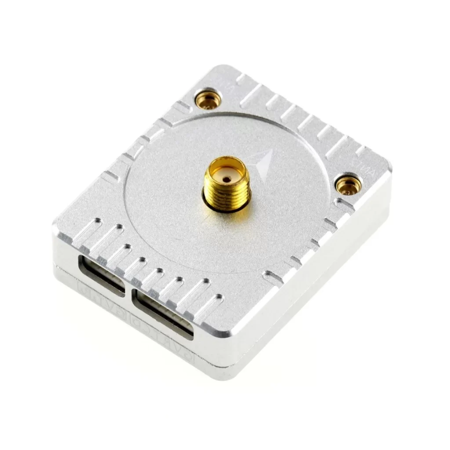
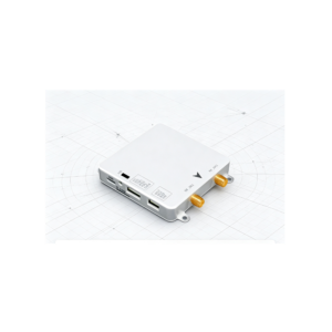
MicoAir MA-RTK-AIR-982 UAV RTK GNSS Rover Module with UM982
Description:
A high-precision rover module based on UM982, supporting L1+L2+L5 multi-band RTK and dual-antenna heading for magnetically harsh industrial environments.
- GNSS Receiver: UM982
- GNSS Band Support: L1 + L2 + L5
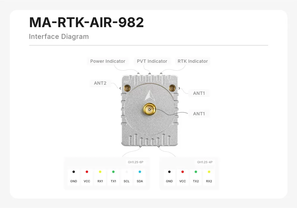
- Satellite Systems: GPS L1C/A, L2P*/L2C, L5*; BDS B1I, B2I, B3I; GLONASS G1, G2; Galileo E1, E5a*, E5b; QZSS L1, L2, L5* (Marked with * are supported only by the main antenna ANT1)
- Onboard Compass: IST8310
- Output Protocol: NMEA-0183, factory default with no data output; ArduPilot/PX4 will configure it automatically
-
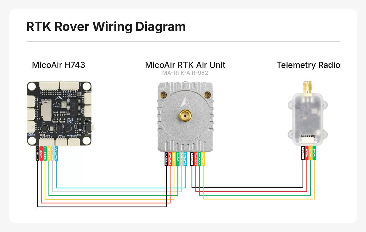
Interface(GPS): UART (3.3V LVTTL)
- Interface(Compass): I2C
- Default Baud Rate: 115200, usually auto-configured by the autopilot to 230400
- Autopilot Support: ArduPilot / PX4
- Max Navigation rate: 20 Hz
- Max Navigation Satellites: 28 (Standalone Mode) / 50+ (RTK Mode)
- RTK Accuracy1: Horizontal 0.8 cm + 1 ppm; vertical 1.5 cm + 1 ppm
- Standalone Accuracy1: 1.5m
- Power / Input Voltage: 700 mW, VCC 4-5 V
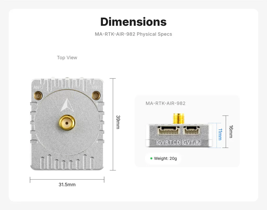
- Size / Weight: 39 x 21.5 x 16 mm; 20 g without antenna
- Interfaces: MMCX x 2, SMA x 1 antenna; GH1.25-6P x 1, GH1.25-4P x 1 data
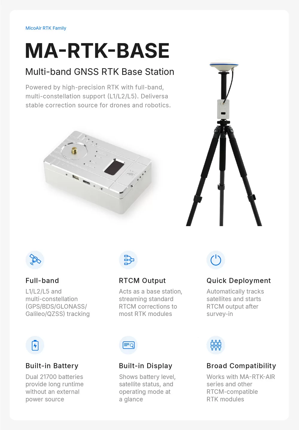
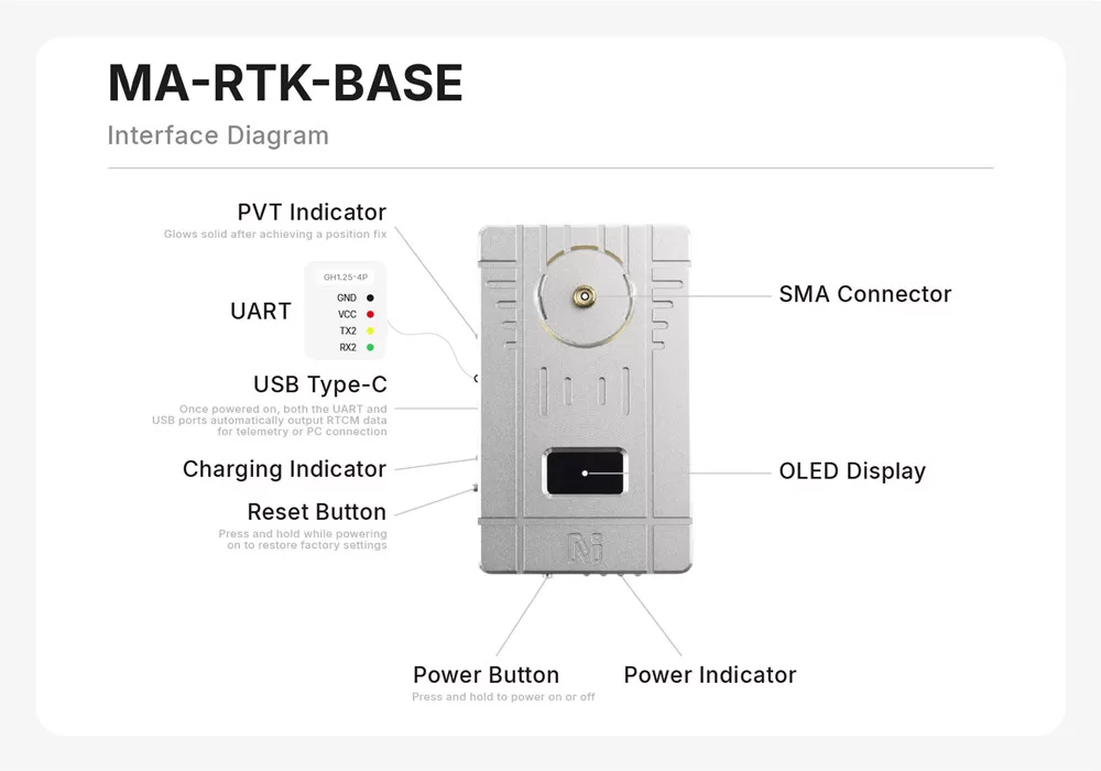
Tripod-mounted GNSS RTK base station with an integrated lithium battery, full-band GNSS reception, and standard RTCM correction output for MicoAir or third-party RTK modules.
- GNSS Receiver: UM982
- Default Port Baud Rate: 115200 ( USB Type-C / UART1 and GH1.25-4P / UART2)
- RTCM Output Rate: 1 Hz by default, configurable with UPrecise software
- Internal Battery: 2 x 21700 lithium cells, 5000 mAh each
- Battery Runtime: Approx. 12 hours with active RTK antenna and a 1 W average-power telemetry radio
- Max Charging Power: 10 W (5 V / 2 A)
- USB-to-UART Chip: CH340
Package Includes:
1xMicoAir MA-RTK-AIR-982 UAV RTK GNSS Rover Module with UM982

ArduPilot Mission Planner: Autonomous Flight Setup
Table of Contents Introduction to ArduPilot Ecosystem Installing Mission Planner Software Connecting Your Flight Controller Calibrating Sensors and...
Read More →
How to Set Up Drone Telemetry with Mission Planner
Table of ContentsWhat Is Drone Telemetry?Why Use Mission Planner?Components You NeedWiring the Telemetry ModuleInstalling Mission Planner on WindowsConnecting...
Read More →
DJI FPV System: Digital HD Video for Racing Drones
Table of Contents Overview of DJI FPV Video System DJI Air Unit and Vista Components DJI FPV Goggles...
Read More →Technical Specifications
| Brand | MicoAir |
|---|---|
| SKU | AI8337 |
| Weight | 0.0 kg |
| Availability | In Stock |
Applications & Use Cases
The MicoAir MA-RTK-AIR-982 UAV RTK GNSS Rover Module with UM982 is a versatile gps modules used across a wide range of applications including drone navigation, asset tracking, fleet management, precision agriculture, and hiking/outdoor gadgets.
Common use cases:
- Adding GPS waypoint navigation to a drone
- Building a vehicle tracker
- Precision positioning for surveying
This product is ideal for drone builders, fleet managers, and outdoor electronics developers.
Technical Tip: Multi-constellation receivers (GPS + GLONASS + BeiDou) provide faster and more accurate fixes. RTK modules offer centimeter-level precision.
Shipping & Delivery
- Free shipping on orders above ₹999 across India
- Dispatched within 1-3 business days
- Expected delivery: 3-7 business days depending on location
- Secure packaging to ensure safe transit of electronic components
- Genuine MicoAir product sourced from authorized channels




Reviews
There are no reviews yet.