
Photogrammetry is the science of creating accurate 3D models and maps from overlapping aerial photographs. In India, this technology is rapidly being adopted by surveyors, architects, civil engineers, archaeologists, and even farmers. This comprehensive guide covers everything from the theory behind photogrammetry to building a capable DIY mapping drone and processing your data into professional deliverables.
1. What Is Aerial Photogrammetry?
Aerial photogrammetry uses the principle of stereo vision — the same way your two eyes perceive depth — applied to overlapping aerial photographs taken from multiple positions. When the camera position and orientation for each photo is known (via GPS and IMU), advanced algorithms like Structure from Motion (SfM) reconstruct the 3D geometry of the terrain or objects below.
The output is a dense point cloud, which can be further processed into:
- Orthomosaic: A geometrically corrected map where every pixel has accurate GPS coordinates.
- Digital Surface Model (DSM): Includes buildings, trees, and all above-ground features.
- Digital Elevation Model (DEM): Bare-earth terrain after removing above-ground objects.
- 3D Mesh: Textured 3D model for visualisation and volume calculations.
2. DJI vs DIY: Which Should You Choose?
This is the question most Indian practitioners face. Here is an honest comparison:
| Factor | DJI (Phantom 4 RTK / Mavic 3E) | DIY Build |
|---|---|---|
| Initial cost | ₹2,50,000–6,00,000 | ₹60,000–1,50,000 |
| Accuracy (RTK) | 1–2 cm (with GCPs) | 2–5 cm (with Emlid RTK) |
| Flight time | 25–45 min | 20–40 min (design-dependent) |
| Repairability | Expensive DJI service centres | Full DIY, parts readily available |
| Customisability | Very limited | Complete freedom |
| Learning curve | Low (plug and fly) | High (build + tune + calibrate) |
| India availability | Good (authorised dealers) | Components via Zbotic + imports |
Our recommendation: If you are a professional needing reliable income from surveys, budget for a DJI. If you are a student, researcher, or enthusiast wanting to learn the full workflow, a DIY build is immensely educational and cost-effective.
3. Camera Selection for Mapping
The camera is the most critical sensor in a photogrammetry drone. Key requirements:
- Global shutter (strongly preferred): Prevents motion blur distortion. Rolling shutter cameras (CMOS in most mirrorless cameras) introduce geometric errors at higher flight speeds.
- Fixed focal length lens: Zoom lenses change focal length between shots, breaking calibration assumptions.
- High resolution: 20MP+ for professional deliverables. More pixels = smaller ground sampling distance (GSD) = finer maps.
- Geotagging: Camera must receive GPS pulse (via FC hot-shoe trigger) to embed precise coordinates in EXIF.
Popular choices for DIY builds in India: Sony a6000 (20MP, affordable, lightweight), Sony RX1R II (42MP, full frame, expensive), MicaSense RedEdge-P (multispectral, for agriculture). For budget mapping, even a GoPro Hero 12 in linear mode works adequately for informal topographic surveys.
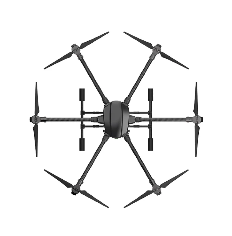
4. DIY Mapping Drone Build
For photogrammetry, the ideal drone prioritises stability, long flight time, and gentle vibration-free flight. A quadcopter with 650–800mm wheelbase is practical. A hexacopter or octocopter adds redundancy (motor failure survivability) for professional applications.
Key design decisions:
- Use carbon fibre arms (not aluminium) to minimise vibration transmission.
- Mount the camera on a 2-axis gimbal for pitch and roll stabilisation — this allows faster flight without blurry images.
- Install a camera trigger cable from the FC (AUX channel) to the camera’s remote trigger port.
- Use a 6S LiPo for the best efficiency-to-weight ratio with large slow-turning propellers.
EFT 6120 Multifunction Surveillance Drone Frame
Heavy-duty professional frame suitable for camera payload and mapping missions. Foldable arms for field portability with ample mounting space.
5. Best Frames for Photogrammetry Drones
Agricultural drone frames repurposed for mapping are an excellent choice — they are engineered for heavy payloads, long flights, and field durability. The EFT agricultural frames offer large payload capacity with folding arms that simplify transport to survey sites across rural India.
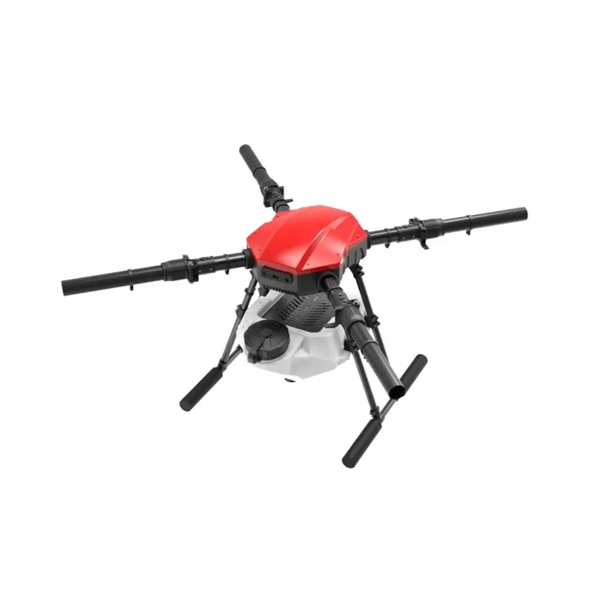
EFT E410P 10L 4 Axis Agricultural Drone Frame
Robust 4-axis frame originally designed for agricultural spraying. Easily adapted for mapping payloads with excellent payload capacity and folding design.
6. Achieving Survey-Grade GPS Accuracy
Standard GPS accuracy of 3–5m is completely inadequate for professional mapping. To achieve the 2–5cm accuracy needed for survey deliverables, you need either:
- RTK GPS on the drone: Real-time centimetre corrections from a ground base station (own hardware or NTRIP network).
- PPK (Post-Processed Kinematic): Cheaper than RTK — log raw GPS data on the drone and process it post-flight against a base station log. Achieves identical accuracy without real-time data link.
- Dense GCPs (fallback): Without RTK/PPK, use 8–15 surveyed GCPs per project — more GCPs improve accuracy but increase field work.

3DR 100mW Radio Telemetry 915MHz for APM PX4 Pixhawk
Reliable telemetry pair for maintaining communication between your drone and ground station during long mapping missions.
7. Flight Planning: Overlap, Altitude & Speed
Photogrammetry quality depends heavily on image overlap. Industry-standard settings:
| Parameter | Standard Survey | High-Detail Survey |
|---|---|---|
| Forward overlap | 75–80% | 85–90% |
| Side overlap | 65–70% | 75–80% |
| Altitude | 80–120m AGL | 30–60m AGL |
| GSD (with 20MP camera) | ~3–5 cm/pixel | ~1–2 cm/pixel |
| Flight speed | 8–12 m/s | 5–8 m/s |
Use free tools like Mission Planner Survey Grid or QGroundControl for waypoint planning. Commercial options like DroneDeploy or Pix4Dcapture offer mobile apps that are easier for field teams without technical backgrounds.
8. Ground Control Points (GCPs) — The Indian Context
GCPs are physical markers placed on the ground whose precise GPS coordinates are known. In India’s survey ecosystem:
- The Survey of India publishes benchmark coordinates — request these from the local state survey office.
- For private land surveys, establish your own benchmarks using a total station referenced to the nearest trigonometric station (TS).
- Print or paint 50×50cm retro-reflective cross targets — highly visible in aerial imagery.
- Distribute GCPs evenly across the survey area, including corners and centre.
- For a 10 hectare area: 5–8 GCPs minimum; for 100 hectares: 10–15 GCPs.
9. Photogrammetry Software Comparison
| Software | Cost | Best For |
|---|---|---|
| Pix4Dmapper | ~₹25,000/month | Professional precision mapping |
| Agisoft Metashape | ~₹12,000 (standard) | Research, archaeology, flexible |
| DroneDeploy | Subscription ~₹8,000/month | Field teams, cloud processing |
| OpenDroneMap (ODM) | Free (open source) | Budget builds, learning, NGOs |
| RealityCapture | Pay-per-input model | Speed, large datasets, 3D mesh |
For Indian students and startups, OpenDroneMap (ODM) via Docker is the recommended starting point — completely free, runs locally, and produces professional-quality outputs.
10. Step-by-Step Processing Workflow
- Import Images: Load all geotagged JPEGs (or TIFFs for RAW workflows) into your chosen software.
- Initial Processing: Feature detection and matching (SfM). The software identifies identical points across multiple photos and computes camera positions.
- Point Cloud Generation: Dense stereo matching creates millions of 3D points.
- GCP Marking: Manually click the centre of each GCP target in 3+ images for each control point. This anchors the model to real-world coordinates.
- Optimise and Reprocess: Run bundle adjustment with GCPs. Check the GCP residuals — ideally below 3cm.
- Generate Products: Export DEM, DSM, orthomosaic, and 3D mesh.
- Quality Report: Always generate and review the software’s quality report. Low image quality scores (below 0.7) indicate blur or insufficient overlap.
Anti-Vibration Shock Absorber for APM/KK/MWC/PixHawk
Silicone damping mount for Pixhawk-class flight controllers. Reduces motor vibration noise that causes blurry survey images and IMU errors.
11. Output Products: DEM, DSM, Orthomosaic
Understanding what each output means is essential for delivering value to clients in India:
- Orthomosaic (GeoTIFF): A drone-era replacement for satellite imagery. Used in GIS software like QGIS or ArcGIS for area calculations, land parcel mapping, and visual inspection.
- DSM: Captures buildings, trees, crop canopy — useful for infrastructure planning and crop health assessment.
- DEM: The bare earth model after removing vegetation and structures. Essential for drainage design, flood modelling, and contour generation.
- Point Cloud (LAZ/LAS): The raw 3D data. Delivered to clients for further analysis in specialised CAD or GIS tools.
- Contour Lines (Shapefile/DXF): 0.5m or 1m contours exported for civil engineering drawings.
12. Applications in India
- SVAMITVA Scheme: Survey of villages using drones for property cards (land ownership records). Multiple state governments are using drone photogrammetry for this.
- PMAY Housing: Site surveys for Pradhan Mantri Awas Yojana construction planning.
- Smart Cities: 3D building models for smart city dashboards in Pune, Indore, Surat.
- Archaeological Survey: ASI uses drone photogrammetry at heritage sites — Hampi, Ajanta, Ellora.
- Precision Agriculture: NDVI mapping from multispectral cameras for crop stress detection.
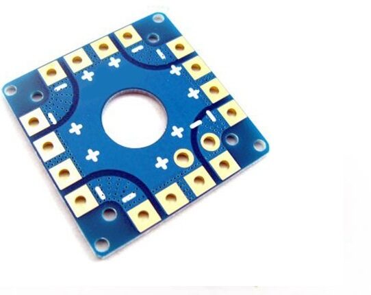
100A Multirotor ESC Power Distribution Battery Board
High-current power distribution board for large hexacopter or quadcopter mapping drones. Handles up to 100A for reliable power delivery.
13. DGCA Regulations for Survey Drones
Under India’s Drone Rules 2021, photogrammetry operations must comply with:
- Drone registration via the Digital Sky Portal (mandatory for all drones above 250g).
- Remote Pilot Certificate (RPC) from a DGCA-approved Remote Pilot Training Organisation (RPTO).
- Prior permission for flights in Yellow or Red zones via the Digital Sky Portal.
- Commercial operators must also obtain a Unique Authorisation Number (UAN).
- For projects under government schemes (SVAMITVA, Smart Cities), state government co-ordination is required — typically a blanket permission is obtained by the nodal agency.
14. Expert Tips for Sharp Results
- Fly in diffuse light: Overcast days produce shadow-free images. Avoid 10 AM–3 PM harsh shadows in summer.
- Camera shutter speed: Set minimum 1/1000s to freeze motion. Use Auto ISO (capped at 800) to compensate.
- Battery protocol: Never land below 20% — voltage sag causes position hold errors and blurry final images.
- Calibrate camera: Run a camera calibration flight before every project if using a new lens or after any impact.
- Cross-hatch flights: A second flight pattern at 90° adds 30% more processing time but eliminates “bowling effect” DSM distortions.
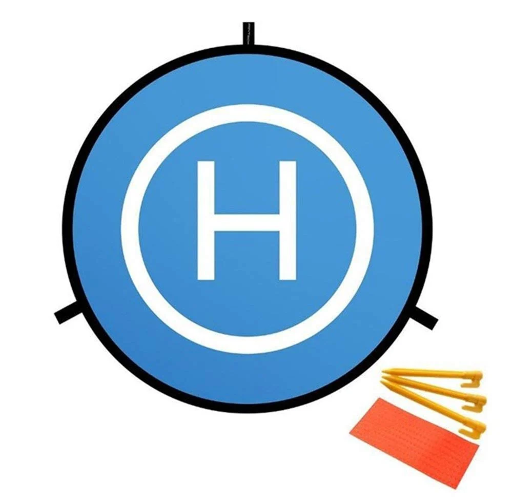
110cm Fast-Fold Landing Pad / Helipad for RC Drones
High-visibility 110cm landing pad for field operations. Waterproof, fast to deploy, and useful as a GCP marker for photogrammetry calibration.
FAQ: Photogrammetry Drone 3D Maps
Can I do photogrammetry with a DJI Mini 3 or Mini 4 Pro?
Yes, for informal surveys and learning. However, the Mini series lacks a global shutter and RTK GPS, limiting accuracy to 5–15cm horizontal (with GCPs). For professional deliverables, use a DJI Phantom 4 RTK, Mavic 3 Enterprise, or a DIY build with an RTK module.
What is the best free photogrammetry software in India?
OpenDroneMap (ODM) is the best free option. It is open source, runs on your own hardware (no cloud subscription needed), and produces orthomosaics, DEMs, and point clouds comparable to commercial software. WebODM provides a user-friendly interface for ODM.
How many images do I need for a 10-hectare photogrammetry survey?
Typically 300–600 images at 80% forward / 70% side overlap, flown at 100m altitude. Processing time is 30–90 minutes on a modern 8-core PC with 32GB RAM.
What accuracy can a DIY photogrammetry drone achieve in India?
With a well-calibrated camera, 8+ GCPs, and RTK GPS, DIY builds regularly achieve 2–5cm horizontal and 3–8cm vertical accuracy — meeting the requirements for many government and private engineering survey projects in India.
Can photogrammetry drones be used under the SVAMITVA scheme?
Yes. SVAMITVA (Survey of Villages and Mapping with Improvised Technology in Village Areas) explicitly uses drone photogrammetry for generating property cards in rural India. Survey of India and NIC are the implementing agencies, and they have authorised private drone service providers in many states.
Build Your Photogrammetry Drone with Zbotic
From frames and flight controllers to propellers, ESCs, GPS antennas, and telemetry radios — Zbotic stocks all the components you need to build a professional photogrammetry drone in India. Fast shipping, quality products, and expert support.


Add comment