
Drone Obstacle Avoidance: Sensors, Systems & Best Builds in India
Obstacle avoidance is one of the most sought-after capabilities in modern drone technology — and for good reason. Flying autonomously in India presents unique challenges: tall eucalyptus trees at field edges, high-tension power lines crossing agricultural land, construction cranes in urban areas, and birds that share your airspace. A single collision can destroy a ₹2-lakh drone build in seconds.
This guide covers everything you need to know about drone obstacle avoidance sensors — the different technologies available, how they integrate with flight controllers like ArduPilot and Betaflight, recommended hardware combinations, and practical build advice for Indian drone operators.
1. Types of Obstacle Avoidance Technology
Before diving into specific sensors, understand the fundamental approaches to obstacle detection and avoidance:
Reactive Avoidance
The drone detects an obstacle and immediately manoeuvres to avoid it — stop, hover, or navigate around. Simple and effective for slow-flying inspection or mapping drones. Used in DJI Phantom, Mavic, and most consumer drones.
Predictive Path Planning
More sophisticated. The drone builds a map of the environment in real time and plans a 3D path that avoids known obstacles. Requires more processing power (companion computer) and more sensors. Used in advanced research drones and some commercial platforms.
Stop-on-Detection (Simplest)
The drone simply stops and hovers when an obstacle is detected within a threshold distance. Not true “avoidance” but prevents collisions. Easy to implement with any distance sensor and a Pixhawk running ArduPilot.
2. Ultrasonic Sensors
Ultrasonic sensors are the simplest and most affordable obstacle detection option. They emit sound waves at 40–200kHz and measure the time for the echo to return.
How They Work on Drones
The sensor emits a burst of ultrasonic pulses and measures the time until the echo returns. Distance = (time × speed of sound) / 2. Detection range is typically 2cm–4m, with some specialised units reaching 6–8m.
Advantages
- Very low cost (₹100–500 per sensor)
- Simple to interface (HC-SR04 uses just 4 pins: VCC, GND, Trig, Echo)
- Works in complete darkness
- Detects transparent objects (glass, water) that cameras miss
Disadvantages
- Narrow beam angle (15–30°) — only detects objects directly in front
- Wind interference — drone downwash disrupts ultrasonic signals, especially in downward-facing applications
- Slow update rate (10–40Hz practical)
- Limited range (typically <5m for reliable readings)
- Cross-talk between multiple sensors if not carefully timed
Best Use
Ultrasonic sensors are excellent as downward-facing rangefinders for terrain following (altitude hold over non-flat ground) and as simple forward collision warning at low speeds. For agricultural spray drones that need to maintain constant height above crop canopy (a critical factor for even chemical distribution), ultrasonic terrain following at 1–3m AGL is standard.
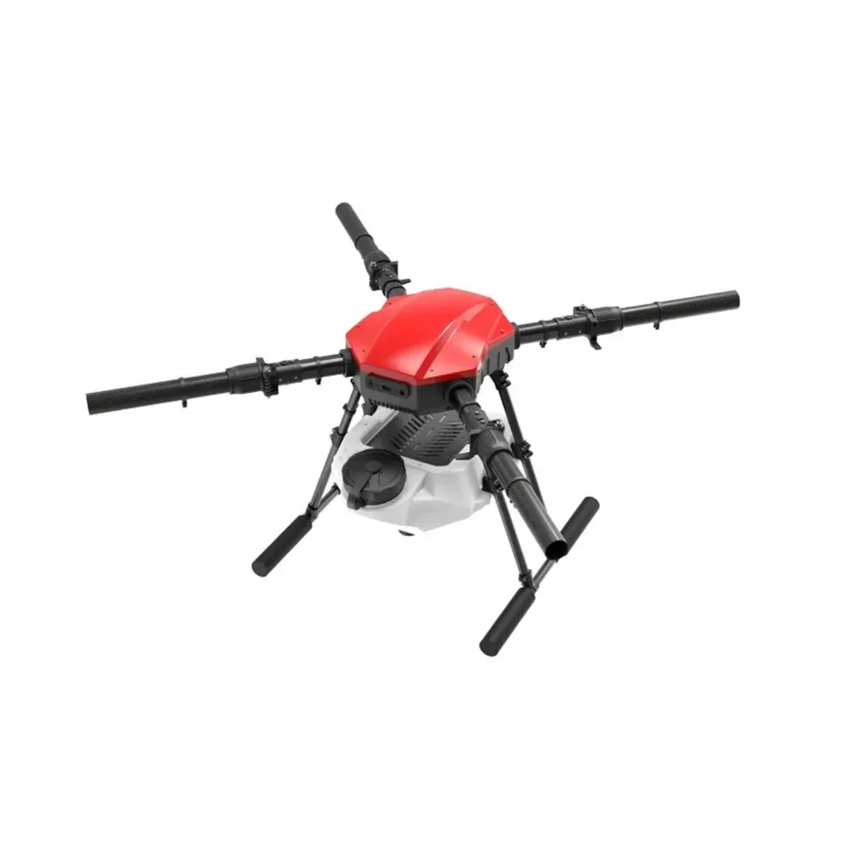
EFT E410P 10L 4 Axis Agricultural Drone Frame
Designed for precision agricultural spraying. Incorporates mounting points for ultrasonic terrain-following sensors to maintain optimal spray height above crop canopy automatically.
View on Zbotic3. Time-of-Flight (ToF) Sensors
ToF sensors use infrared laser or LED pulses (not ultrasound) to measure distance. They’re faster, more accurate, and less affected by wind than ultrasonic sensors.
Popular ToF Sensors for Drones
- TFmini / TFmini-S (Benewake) — very popular for ArduPilot rangefinders. 12m range, UART/I2C interface, 100Hz update rate. Widely available in India at ~₹2,500–4,000
- TF-Luna (Benewake) — compact single-point LiDAR ToF sensor, 8m range, I2C/UART, excellent value at ~₹1,500
- VL53L1X (ST Microelectronics) — tiny breakout board ToF sensor, 4m range, I2C. Great for micro builds where weight is critical
- Garmin LIDAR-Lite V3 — 40m range, very accurate, I2C/PWM. Premium option for precision terrain following
Advantages over Ultrasonic
- Much less affected by wind and motor downwash
- Higher update rates (100Hz+)
- Better range (5–40m depending on model)
- More reliable in all weather conditions
Disadvantages
- Still narrow field of view (single-point measurement)
- Glass and some transparent surfaces can cause false readings
- Some ToF sensors struggle in bright direct sunlight (India’s summer sun is intense)
- Higher cost than ultrasonic
ArduPilot Integration
Most ToF sensors interface with ArduPilot via the RNGFNDx parameters. Set RNGFND1_TYPE to the appropriate sensor type (19 for TFmini over UART, 16 for Benewake via I2C), configure the UART/I2C port, and ArduPilot automatically uses it for terrain following in Auto mode when TERRAIN_ENABLE is set.
4. Stereo Vision Systems
Stereo vision obstacle avoidance uses two cameras (like human eyes) to calculate depth and build a 3D map of the environment. This is the approach used in DJI’s APAS (Advanced Pilot Assistance System).
How It Works
Two cameras offset horizontally capture simultaneous frames. A vision processor calculates disparity (pixel offset between matching features in both images) and converts this to depth. The result is a dense 3D point cloud of obstacles ahead.
Options for Custom Builds
- Intel RealSense D435i — RGB-D camera with integrated IMU, ideal for companion computer obstacle avoidance (ROS/ArduPilot companion). 3–10m range, USB3.0. ~₹18,000–25,000
- Intel RealSense T265 — tracking camera for VIO (visual-inertial odometry), works alongside depth camera for full navigation
- OpenMV H7 stereo kit — low-cost MicroPython vision system for basic obstacle detection
- Arducam stereo kit — Raspberry Pi compatible stereo camera for companion computer obstacle avoidance
Advantages
- Wide field of view — can detect obstacles across a broad scene
- Can detect thin objects (wires, branches) that ToF sensors miss
- Provides full depth map for sophisticated path planning
- No moving parts
Disadvantages
- Computationally intensive — requires a companion computer (Raspberry Pi 4, Jetson Nano, etc.)
- Fails completely in low light or direct sun glare (common in Indian afternoons)
- Cannot detect transparent objects (glass, water)
- Higher power consumption and weight
- Requires careful calibration
5. LiDAR Sensors
Proper 2D or 3D LiDAR (Light Detection And Ranging) scanners provide the most comprehensive obstacle detection by spinning a laser and measuring returns across a full 360° horizontal plane or 3D volume.
2D LiDAR (Spinning)
Units like the RPLIDAR A1/A2/A3 (from Slamtec, ~₹8,000–25,000) scan a 360° horizontal plane at 5.5–15Hz. Excellent for mapping indoor environments or ground-level navigation (used in AGVs and robots). On drones, they detect obstacles in a horizontal band — misses obstacles above and below the scan plane.
3D LiDAR
Multi-beam LiDAR units (Velodyne VLP-16, Livox Mid-40, Ouster OS0) provide full 3D point clouds. Excellent for autonomous flight in complex environments. Cost: ₹3–20 lakh. Weight: 500g–2kg. Only viable on large hexacopters/octocopters. More common in research and industrial platforms.
Solid-State LiDAR
Emerging technology — no moving parts, more compact and durable. Options like Livox Avia are being integrated into commercial agricultural drones. Expected to become more affordable in the next 2–3 years and relevant for premium Indian drone builds.
ArduPilot LiDAR Integration
ArduPilot supports RPLIDAR and other 2D LiDARs via the PROXIMITY library. Configure PRX_TYPE for your sensor and ArduPilot will use it for collision avoidance in Loiter, Auto, and Guided modes through the AP_Proximity_Avoidance system.
6. Radar Sensors (Microwave)
Radar uses microwave frequency electromagnetic waves to detect obstacles. Key advantage: works in all weather conditions — rain, fog, dust storms (increasingly common in Rajasthan and NCR) — where optical sensors fail completely.
Drone Radar Options
- Ainstein US-D1 — small microwave radar altimeter, 50m range, weather-independent. Used in commercial agricultural drones for terrain following in foggy/dusty conditions
- RFbeam V-Band radar — velocity and distance measurement sensor, automotive-grade
- Waveguide 24GHz radar modules — available on Alibaba for ₹3,000–8,000, but integration with ArduPilot is custom work
When to Use Radar in India
Indian conditions that defeat optical sensors:
- Pre-monsoon dust storms (andhis) in North India
- Dense winter fog in Punjab/UP agricultural belts (November–January)
- Smoke from agricultural waste burning
- Hazy/smoggy conditions in Indian metros
For truly all-weather autonomous operations in India, microwave radar altimeters (terrain following) combined with optical/ToF for obstacle detection is the robust solution.
7. ArduPilot Integration & Configuration
ArduPilot has mature support for obstacle avoidance through two subsystems:
Rangefinder System (RNGFNDx)
Used for terrain following (downward-facing sensors) and single-direction obstacle detection. Key parameters:
RNGFND1_TYPE— sensor type (2=MaxBotix analog, 10=I2C, 19=TFmini UART, etc.)RNGFND1_ORIENT— mounting direction (0=down, 4=forward, 8=backward, 6=right, 2=left, 24=up)RNGFND1_MAX_CM— maximum reliable range in centimetresRNGFND1_MIN_CM— minimum reliable range
Proximity System (PRXx)
Used for 360° obstacle avoidance with 2D LiDAR or multi-sensor setups:
PRX_TYPE— sensor type (5=RPLIDAR, 11=LightWareSF45B, etc.)AVOID_ENABLE— enable avoidance (1=stop at boundary, 2=slide around obstacles)AVOID_MARGIN— distance at which to start avoiding in cmOA_TYPE— obstacle avoidance algorithm (1=BendyRuler, 2=Dijkstra)
OA (Object Avoidance) Path Planning
ArduPilot 4.x introduced sophisticated OA algorithms:
- BendyRuler — real-time path bending to navigate around detected obstacles. Works well in open environments. Low computational cost.
- Dijkstra — builds a full path graph and finds the shortest obstacle-free path. More computationally intensive but better in complex environments.

3DR 100mW Radio Telemetry 915MHz for Pixhawk/APM
Monitor your drone’s obstacle avoidance status in real time via Mission Planner. This telemetry radio streams proximity sensor data, OA status, and flight mode to your GCS.
View on Zbotic8. Best Sensor Combinations by Use Case
Agricultural Spray Drone (India Focus)
Priority: terrain following for consistent spray height + basic forward/side collision stop
- Down: TFmini-S LiDAR rangefinder (2–12m range, handles crop canopy well)
- Forward: TF-Luna or HC-SR04 ultrasonic (simple stop-on-detect)
- Side: Optional ultrasonic for field boundary detection
- ArduPilot RNGFND terrain following + simple proximity stop
Survey / Mapping Drone
Priority: basic collision prevention in Auto mode during photo passes
- Down: Garmin LIDAR-Lite V3 (40m range for high-altitude operations)
- Forward + Backward: TFmini-S
- ArduPilot OA BendyRuler for gentle path deviations
Inspection / Surveillance Drone
Priority: full 360° situational awareness in complex environments
- 360° horizontal: RPLIDAR A2 or A3
- Up + Down: TF-Luna sensors
- Forward: Intel RealSense D435i for detailed frontal depth mapping
- ArduPilot OA Dijkstra + companion computer for complex path planning
FPV Racing / Freestyle
Obstacle avoidance is NOT used in racing — it would interfere with aggressive manoeuvres. Focus on pilot skill and track design instead.
9. Build Recommendations for India
Agricultural Spray Drone with Obstacle Avoidance
This is the most commercially relevant application in India currently. A complete build recommendation:
- Frame: EFT E416P 16L (larger payload for spray tank + sensors)
- FC: Cube Orange or Pixhawk 4 with ArduPilot
- GPS: HERE3 or Beitian BN-880 (M8N)
- Motors: T-Motor or Hobbywing X9 Plus for maximum efficiency
- ESC: 100A 4-in-1 or individual Flame ESCs
- Terrain sensor: TFmini-S (downward, UART)
- Forward obstacle: TFmini-S or RPLIDAR A1 (PRX mode)
- RC link: ELRS 900MHz or TBS Crossfire
- GCS telemetry: 3DR 433MHz radio set
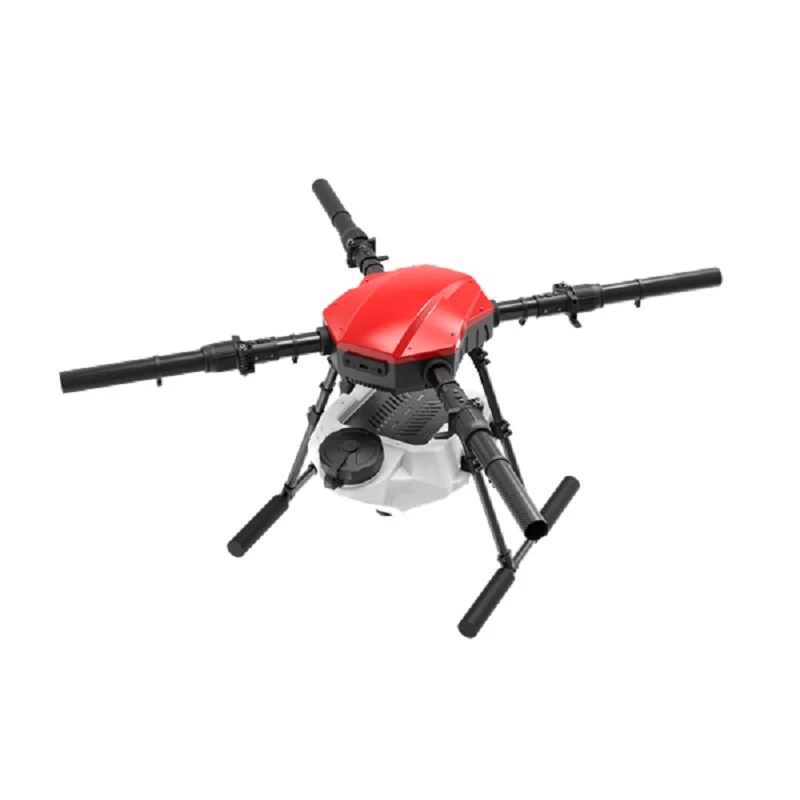
EFT E416P 16L 4 Axis Agricultural Drone Frame
16-litre agricultural spray drone frame with 4-axis layout. Ample payload capacity for spray tank, sensors, and battery. The professional choice for Indian agriculture drone operators.
View on Zbotic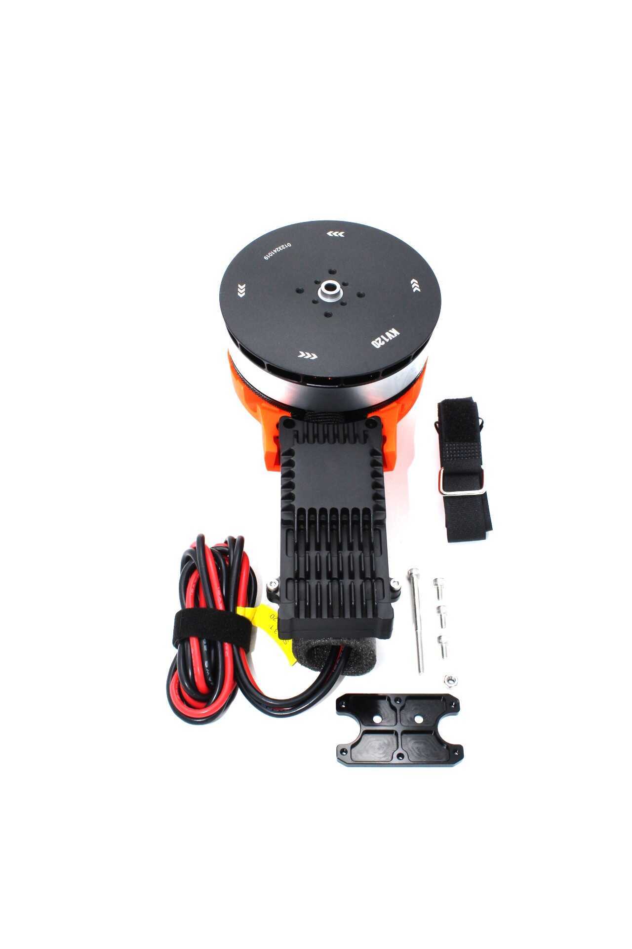
T-Motor A10-KV120-CCW Modular Propulsion System
High-efficiency modular propulsion system from T-Motor. Designed for heavy-lift drones requiring maximum thrust efficiency for long agricultural spray missions.
View on Zbotic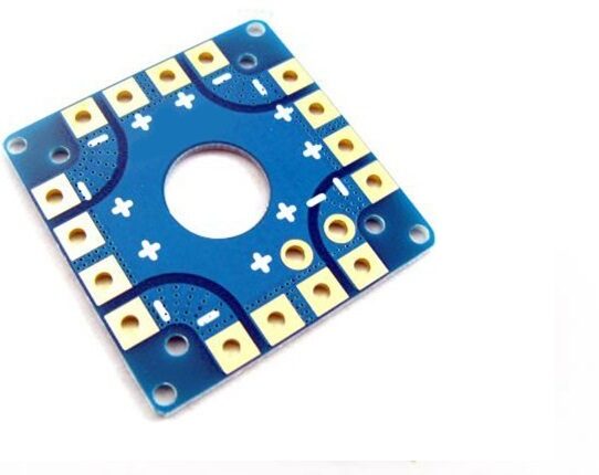
100A Multirotor ESC Power Distribution Battery Board
High-current PDB for agricultural and heavy-lift drones. 100A continuous rating handles demanding motor loads while providing clean regulated power to flight controller and sensors.
View on Zbotic10. Limitations & What Obstacle Avoidance Can’t Do
Obstacle avoidance is a safety aid, not a replacement for careful flight planning and pilot responsibility. Understand these critical limitations before relying on it:
Thin Wire Problem
Power lines — a huge hazard in Indian rural and urban environments — are notoriously difficult to detect. Their narrow profile reflects very little LiDAR or ultrasonic energy. Even DJI’s sophisticated APAS system struggles with thin wires. Never rely on obstacle avoidance to detect power lines. Always survey your flight path visually before autonomous missions.
Speed Limitation
Obstacle avoidance only works effectively at low to moderate speeds. At high speeds, the drone doesn’t have time to stop or manoeuvre before reaching a detected obstacle. Most systems work reliably at 5–8 m/s forward speed; at 15+ m/s, effective stopping distance exceeds most sensor ranges.
Sensor Coverage Gaps
Even with multiple sensors, there are always blind spots. A drone with front and rear sensors has no protection from objects entering from the sides unless side sensors are also fitted. Full 360° + up + down coverage requires 6+ sensors, significant weight, and processing overhead.
False Positives
In agricultural environments, tall grass, crop canopy, or even rain drops can trigger obstacle detections and cause unnecessary stops. Tuning avoidance margins and sensor parameters for the specific Indian agricultural environment (sugarcane fields are particularly challenging with dense 3–4m high crop) takes field testing time.
GPS Dependency
Most ArduPilot obstacle avoidance modes require GPS fix. Under thick tree canopy or in GPS-denied environments, avoidance features may be unavailable. For indoor or GPS-denied operations, optical flow + ToF rangefinder is needed for position hold.
Frequently Asked Questions
Q: Does obstacle avoidance work in Auto (waypoint) mode in ArduPilot?
Yes, ArduPilot’s OA (Object Avoidance) system is specifically designed to work in Auto mode. When an obstacle is detected during a waypoint mission, the BendyRuler or Dijkstra algorithm reroutes the path around the obstacle and then returns to the original mission path. This is enabled by setting OA_TYPE and AVOID_ENABLE parameters.
Q: Can I add obstacle avoidance to any existing drone?
Yes, if your drone runs ArduPilot or iNav on a Pixhawk-class flight controller. You need a spare UART or I2C port for the sensor, physical mounting space, and the ability to update FC parameters. Betaflight does not natively support obstacle avoidance — it’s purely a manual/racing firmware.
Q: What is the best obstacle avoidance sensor for beginners in India?
Start with a TFmini-S or TF-Luna LiDAR rangefinder. These are affordable (₹1,500–4,000), easy to interface with ArduPilot, well-documented, and provide reliable terrain following (downward) and basic forward obstacle stop. The HC-SR04 ultrasonic is even cheaper but less reliable in drone motor downwash.
Q: How does terrain following work in ArduPilot?
In Auto mode, ArduPilot can follow terrain contours using either SRTM terrain data (downloaded from internet to SD card) or a downward-facing rangefinder. With TERRAIN_ENABLE=1 and a rangefinder, the drone maintains a constant height AGL regardless of elevation changes below — critical for consistent spray coverage on undulating farmland.
Q: Does obstacle avoidance increase flight time significantly?
The sensors themselves add minimal weight (50–200g for most setups) and negligible power consumption (<5W total for a multi-sensor setup). The flight time impact is usually <5%. Path detouring to avoid obstacles can increase total mission distance and thus time, but this is a safety benefit, not a drawback.
Q: Is LiDAR-based obstacle avoidance required for DGCA type certification?
As of 2024, DGCA type certification requirements for agricultural drones under the PLI scheme and drone policy specify terrain following and basic obstacle detection as desirable features. Specific sensor types are not mandated but drones sold for agricultural use in India increasingly include at minimum ultrasonic terrain following. Check latest DGCA circulars and the NPNT (No Permission No Takeoff) integration requirements for the most current rules.
Build a Smarter, Safer Drone
From agricultural drone frames to professional propulsion systems, telemetry radios, and power distribution boards — Zbotic has all the components to build your obstacle-avoidance equipped autonomous drone. Fast delivery across India.
Shop at Zbotic


Add comment