
Standard GPS gives you accuracy of 2–5 metres — enough to navigate a drone to a general location, but nowhere near precise enough for precision agriculture, land surveying, automated inspection, or waypoint missions that require repeatable centimetre-level positioning. Enter RTK GPS (Real-Time Kinematic): the technology that enables centimetre-accurate drone navigation, and which is rapidly becoming mainstream even in Indian drone builds.
This guide explains the technology from the ground up, walks you through what hardware you need, and covers the specific considerations for deploying RTK GPS systems in India.
1. What Is RTK GPS and How Does It Work?
RTK (Real-Time Kinematic) is a satellite navigation technique that uses carrier-phase measurements of GPS/GNSS signals to achieve centimetre-level accuracy. Unlike standard GPS which uses signal timing (pseudoranges), RTK uses the actual phase of the carrier wave — a much more precise measurement.
The Basic Principle
RTK requires two receivers working together:
- Base station (reference receiver): Placed at a precisely known location (or surveyed in). It receives GPS signals and computes the errors in those signals by comparing received position with its known position.
- Rover (mobile receiver): Mounted on the drone. Receives the same GPS signals AND receives the base station’s correction data via a radio or internet link.
The rover subtracts the base station’s error measurements from its own, effectively cancelling out the common errors (atmospheric delays, satellite clock errors, multipath). The result: position accuracy of 1–2 centimetres horizontally and 2–3 centimetres vertically.
The Two Key Modes
- Fixed mode: RTK has resolved the integer ambiguity in the carrier phase — giving full centimetre accuracy. Indicated by a green RTK Fixed status in ground control software.
- Float mode: RTK is working but hasn’t yet resolved ambiguities — accuracy is 0.2–1 metre. Better than standard GPS but not centimetre-level. Avoid operating precision missions in Float mode.
2. RTK vs Standard GPS: The Numbers
| Parameter | Standard GPS (M8N/M9N) | RTK GPS (Fixed) |
|---|---|---|
| Horizontal accuracy | 2–5 metres CEP | 1–2 cm CEP |
| Vertical accuracy | 5–10 metres | 2–3 cm |
| Time to first fix | 30–60 seconds | 30–120 seconds to Fixed |
| Requires base station? | No | Yes (or NTRIP network) |
| Works in multipath? | Degraded | Significantly degraded |
| Cost (GPS only) | ₹500–3,000 | ₹20,000–80,000+ |
The accuracy improvement is roughly 100–500x. For agricultural variable rate application, survey-grade mapping, or automated structure inspection, this difference is the difference between a useful tool and a precise instrument.
3. Components Needed for a Drone RTK System
The Rover Unit (on the drone)
The drone-mounted RTK receiver. Popular options for ArduPilot/PX4 drones:
- Here3+ (CubePilot): A popular ArduPilot-compatible RTK GPS module with CAN interface. Widely used in Indian agricultural drone builds.
- u-blox ZED-F9P based modules: The ZED-F9P is the gold standard chipset for UAV RTK. Several manufacturers (ArduSimple, SparkFun, Holybro) make breakout boards. Holybro H-RTK F9P is widely used with Pixhawk.
- SimonK/BN-220 RTK modules: Budget RTK options available for prototyping.
The Base Station
A second RTK receiver placed at a known point. It transmits RTCM correction data to the rover. The base station connects to your GCS laptop or directly to a telemetry radio that broadcasts corrections.
Data Link for Corrections
Corrections must reach the rover in real time (latency under 1–2 seconds is acceptable). Options:
- 433 MHz telemetry radio: Simplest option for short range (up to 1km practical in India). Base station → GCS → rover.
- 915 MHz radio: Note that 915 MHz is not in the ISM band in India — use 433 MHz instead.
- LTE modem: For longer range, the base station can send corrections via an NTRIP server over 4G and the drone rover receives via its own 4G modem. Excellent for agricultural operations in India.
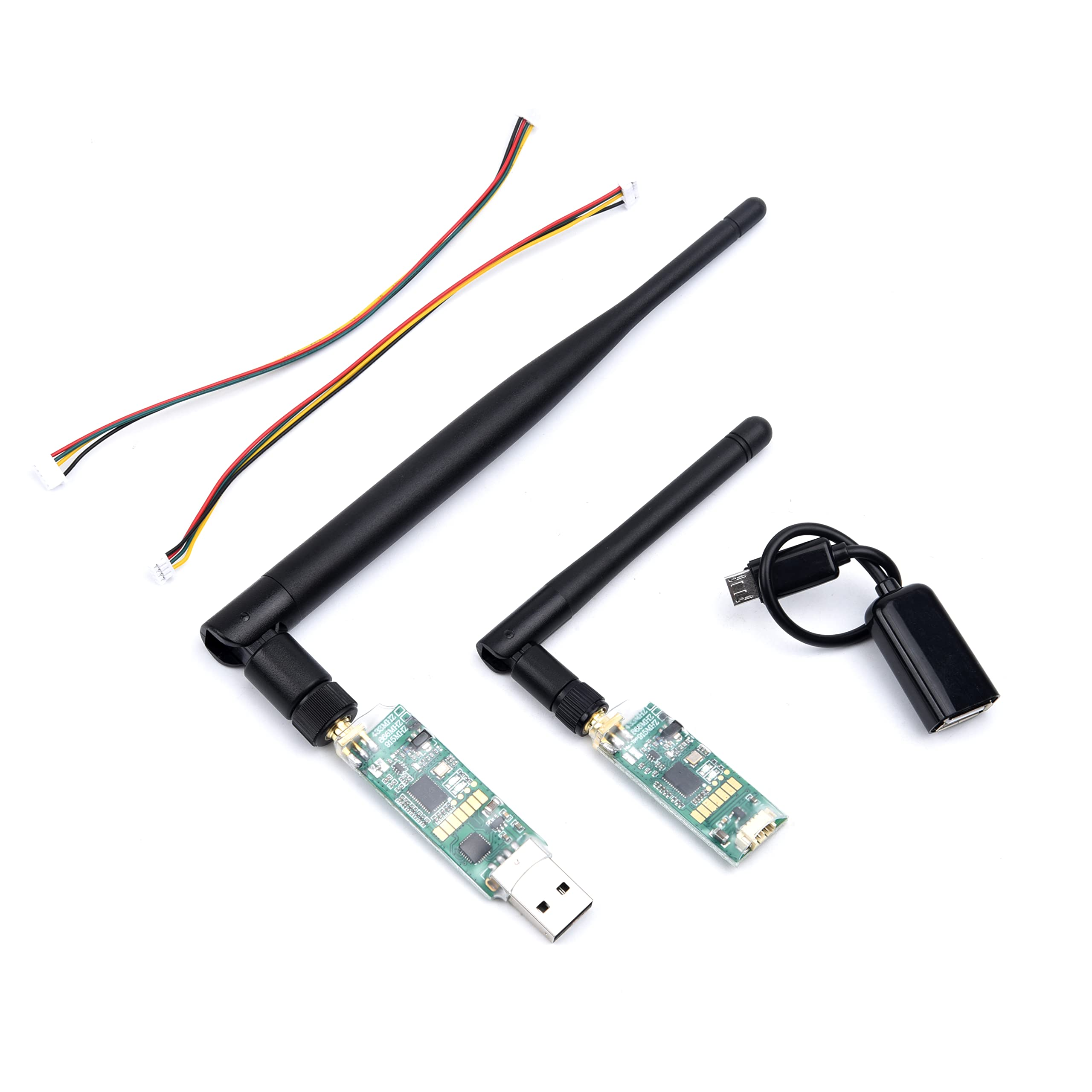
3DR Single TTL Mini Radio Telemetry 433MHz 500mW
A high-power 433MHz telemetry radio capable of transmitting RTK corrections from your base station to the drone. The 500mW output gives reliable 1–2km range in open fields — adequate for most Indian agricultural RTK deployments without needing LTE.

3DR 100mW Radio Telemetry 915MHz for APM/PX4/Pixhawk
Another option for telemetry data transmission between GCS and drone. These modems support MAVLink injection of RTCM data, making them compatible with RTK workflows in Mission Planner. Note: use the 433MHz version for licence-free operation in India.
The Drone Frame
RTK GPS is typically used on larger drones — the added weight of the RTK module (100–200g typically) and requirement for clear sky view make it best suited to purpose-built agricultural or survey frames.
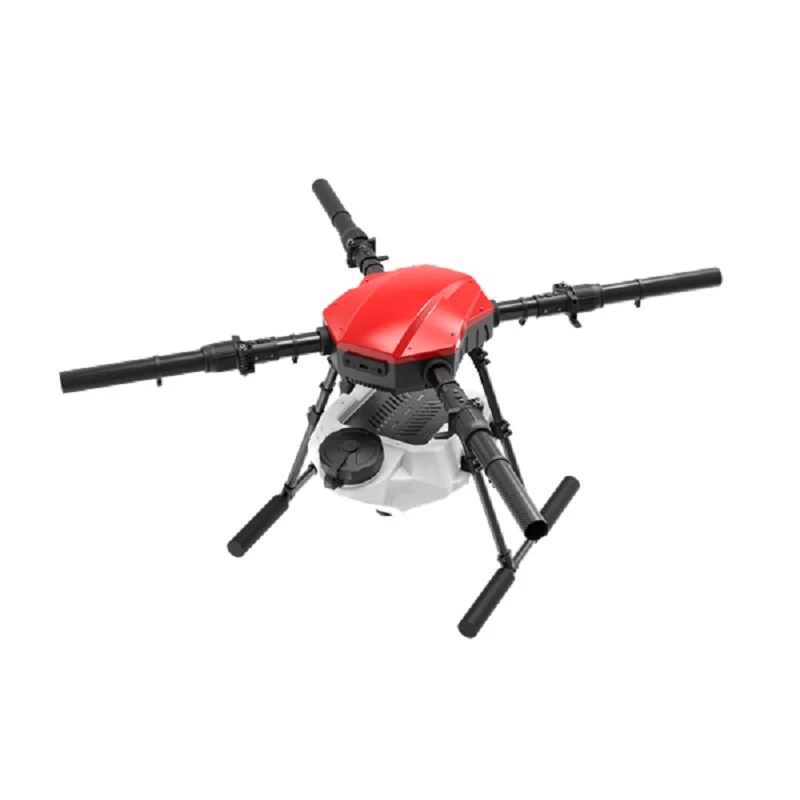
EFT E416P 16L 4-Axis Agricultural Drone Frame
A heavy-duty agricultural drone frame with 16L tank capacity — ideal for precision agriculture deployments where RTK GPS enables centimetre-accurate variable-rate spraying. The large frame provides ample space for RTK module mounting away from interference sources.
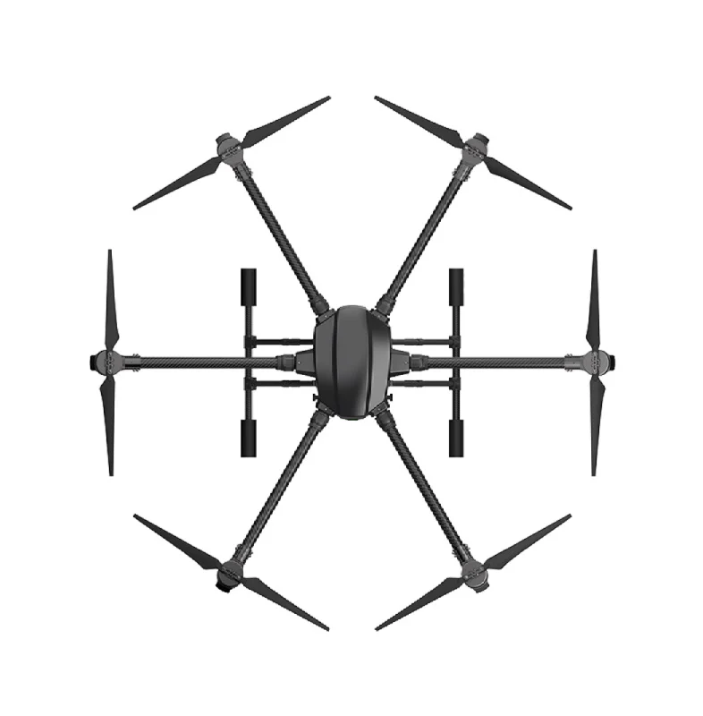
EFT 6120 Multifunction Surveillance Drone Frame
A hexacopter frame designed for surveillance missions where RTK GPS enables precise position holds for long-duration monitoring and repeatable patrol routes. The 6-motor configuration also provides motor-out redundancy — critical in professional operations.
Power Distribution
A proper power distribution board ensures clean, regulated power to both the flight controller and RTK module. GPS receivers are sensitive to power noise — use separate clean power rails.
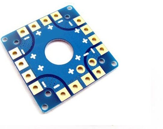
100A Multirotor ESC Power Distribution Battery Board
A robust 100A power distribution board for large multirotor builds. Professional RTK drones draw significant current — this board handles the load while providing clean power outputs for electronics including the RTK receiver module.
4. Base Station Options in India
In India, you have three main approaches for providing the reference station corrections:
Option 1: Self-Deployed Portable Base Station
You carry a second RTK receiver in the field, set it up on a tripod at a known benchmark point (or let it “survey-in” for 5–10 minutes to determine its own position). This is the most common approach for agricultural contractors in India. The base station transmits corrections via a 433MHz radio link to the drone’s rover.
Accuracy: 1–3cm horizontal after survey-in convergence.
Range: Limited by radio range (typically 1–3km with standard radios).
Cost: Additional RTK module + radio + tripod + battery.
Option 2: NTRIP via 4G/LTE
Use an existing network of CORS (Continuously Operating Reference Stations) via the NTRIP protocol. The drone connects to an NTRIP server over 4G and receives corrections from the nearest reference station (potentially 10–50km away — still centimetre accurate in most conditions).
Accuracy: 2–5cm horizontal (slightly worse than local base due to longer baseline).
Range: Unlimited — works wherever 4G is available.
Cost: NTRIP subscription (₹3,000–10,000/month for commercial CORS networks in India).
Option 3: Survey Control Points + Post-Processing (PPK)
Not real-time, but mentioned for completeness. PPK (Post-Processing Kinematic) uses a base station log and rover log combined after the flight to achieve the same or better accuracy than RTK. Popular in photogrammetry where you collect raw logs and process with Agisoft Metashape or similar.
5. NTRIP and CORS Networks in India
India’s CORS infrastructure is growing but not yet as mature as Europe or North America. Key players:
Survey of India (SoI) CORS Network
The Survey of India operates a growing CORS network under their National CORS Network (NCN) initiative. Access is being expanded but was historically restricted to government and licensed surveyors. Check current access policies at survey.gov.in.
State Survey Departments
Several states (Maharashtra, Karnataka, Telangana, Gujarat) have invested in their own CORS networks for land administration. Agricultural departments in some states provide CORS access to registered drone operators.
Private CORS Services
Companies like Trimble, Leica, and several Indian geospatial firms offer NTRIP correction subscription services with their own or resold CORS networks. Pricing varies significantly — enquire with local distributors.
Setting Up NTRIP in Mission Planner
- In Mission Planner, go to Initial Setup → Optional Hardware → RTK/GPS Inject.
- Enter your NTRIP server URL, port, mountpoint, username, and password.
- Mission Planner downloads RTCM corrections and injects them into the MAVLink stream to the drone’s RTK module automatically.
- Watch for the RTK status to change from FLOAT → FIXED.
6. Moving Baseline RTK: For Heading Accuracy
A fascinating capability of dual RTK receivers is Moving Baseline RTK. Instead of comparing against a fixed point, two RTK receivers on the same drone measure their relative position to each other — yielding extremely accurate heading information (0.1–0.3 degrees) without relying on a magnetometer.
Why This Matters
Magnetometers (compasses) on drones are notoriously susceptible to interference from power wires, metal frames, and nearby motors. This is especially problematic on large agricultural drones with high current motors. GPS-derived heading from Moving Baseline RTK is immune to these interference sources.
How to Configure (ArduPilot)
- Mount two RTK GPS antennas on the drone’s arms, separated by at least 30cm (more = better accuracy).
- Connect both to an F9P-based dual-antenna module or two separate ZED-F9P boards.
- Set
GPS_TYPE = 17(UBlox Moving Baseline) in ArduPilot parameters. - Configure the antenna offsets relative to the centre of gravity.
- Disable the magnetometer (
COMPASS_USE = 0) once Moving Baseline heading is verified accurate.
7. RTK GPS with ArduPilot
ArduPilot has excellent RTK GPS support as of version 4.3+. The workflow in Mission Planner:
Step-by-Step Setup
- Hardware connection: Connect your RTK rover to the flight controller’s GPS port. Most ZED-F9P modules communicate via UART at 115200 baud.
- Parameter setup: Set
GPS_TYPE = 17for ublox F9P (or appropriate type for your module). SetGPS_RATE_MS = 100for 10Hz update rate. - Mission Planner RTCM injection: In the RTK/GPS Inject tab, connect to your base station or NTRIP server. Watch the GPS status bar in Mission Planner change from 3D Fix → RTK Float → RTK Fixed.
- EKF source: ArduPilot’s EKF3 will automatically prefer the RTK-corrected GPS when HDOP drops below 1.5 (typical of Fixed mode). You can verify with
EKF_GPS_TYPEparameter. - Test: Before flying autonomous missions, hover in one spot for 2–3 minutes and observe the position drift in Mission Planner. With RTK Fixed, the reported position should drift less than 5cm.
Anti-Vibration Mounting
RTK GPS module placement on the drone is critical. Mount away from motors and ESCs (minimum 10cm), away from high-current wires, and with the antenna having a clear view of the sky above 15° elevation. Vibration isolation is also important — though GPS receivers are less vibration-sensitive than IMUs, excessive vibration can cause electrical noise in the power lines feeding the receiver.
Anti-Vibration Shock Absorber for APM/KK/MWC/PixHawk
Proper vibration isolation for the flight controller stack. On RTK drones where position accuracy is paramount, even small IMU vibration artifacts can degrade EKF performance and reduce the effective benefit of RTK corrections.
8. Key Applications in India
Precision Agriculture
India has enormous agriculture land area — 170 million hectares. RTK GPS enables variable-rate spraying based on field maps, centimetre-accurate row tracking for repeat spraying missions, and integration with crop health maps derived from multispectral imagery. Indian states like Punjab, Haryana, Maharashtra, and AP are leading adoption of drone-based precision agriculture.
Land Survey and Mapping
RTK GPS on survey drones enables ground sample distances of 1–3cm in photogrammetry without the need for hundreds of ground control points. This dramatically speeds up land survey in India — relevant for government projects, infrastructure development, and real estate development in rapid-growth cities.
Infrastructure Inspection
Power line inspection, pipeline monitoring, and bridge inspection all benefit from RTK GPS — the drone can follow a precise pre-programmed path that repeats identically on each inspection visit, making change detection between surveys much easier.
Mining and Earthworks
India has significant mining operations in Odisha, Jharkhand, Chhattisgarh, and Rajasthan. RTK-equipped drones measure stockpile volumes, track cut-and-fill progress, and generate accurate site topography — replacing traditional survey methods that take days with flight sessions that take hours.
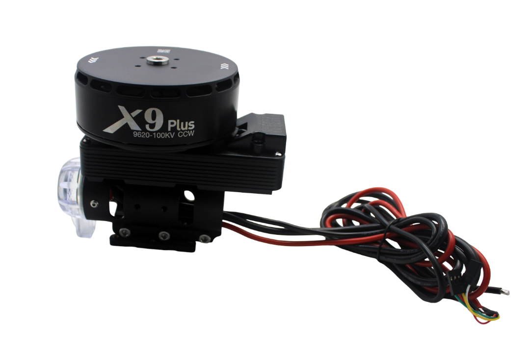
Hobbywing X9 Plus Motor CCW
A high-efficiency motor for large professional drones. RTK survey and agriculture drones typically carry heavy payloads — the X9 Plus delivers the thrust efficiency needed for long-duration missions with RTK receiver and mapping camera payloads.
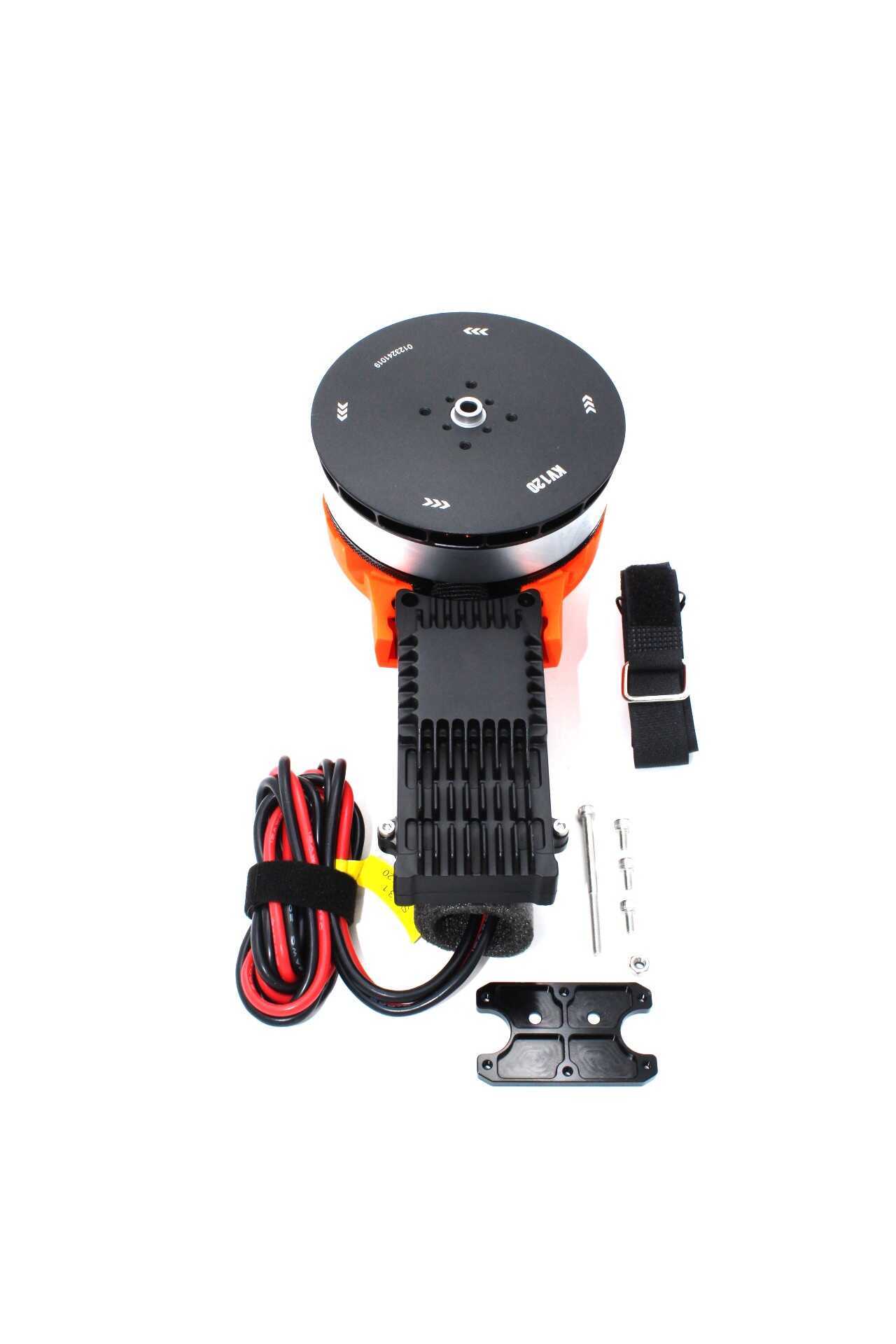
T-Motor A10-KV120-CCW Modular Propulsion System
T-Motor’s premium modular propulsion system. For RTK survey drones where flight time directly equals more mapped area, high efficiency motors like the A10 are the right investment. The modular design simplifies maintenance in field conditions.
FAQ
Q: Does RTK GPS work indoors?
A: No. RTK GPS requires clear sky visibility to multiple GNSS satellites. Indoor positioning requires different technologies like UWB (Ultra-Wideband) beacons or optical flow — also supported by ArduPilot but a different system entirely.
Q: How long does it take to get RTK Fixed status?
A: Typically 30–120 seconds after the rover receives corrections from the base station. Cold start (no prior convergence data) takes longer. Warm start (drone remembers last fixed position) can converge in under 30 seconds. Always wait for Fixed status before starting autonomous missions.
Q: Can RTK GPS lose Fixed status during a flight?
A: Yes, if the communication link to the base station is interrupted, or if the drone flies into an area with poor sky visibility (near tall buildings, tree canopy). ArduPilot falls back to Float mode and then to standard GPS. The drone continues to fly safely but position accuracy degrades.
Q: What is the maximum base station to rover distance?
A: For RTK, the practical limit is around 30–50km baseline (longer baselines degrade accuracy). For NTRIP, the network manages this by providing the nearest available reference station. In India’s growing CORS network, most agricultural areas should be within 50km of a reference station.
Q: Is RTK GPS worth it for a hobbyist?
A: Generally no. The cost is significant (₹30,000–80,000+ for a proper RTK setup) and standard GPS is more than adequate for recreational flying. RTK makes economic sense when you’re doing professional mapping, surveying, or precision agriculture where the accuracy directly translates to revenue or quality of deliverables.
Conclusion
RTK GPS is transforming what drone-based precision agriculture, survey, and inspection can achieve in India. From 2-metre GPS to 2-centimetre RTK is not just an incremental improvement — it’s an entirely different category of capability that enables applications which were previously impossible or prohibitively expensive with traditional survey methods.
For builders and operators ready to invest in professional-grade drone systems, the combination of a quality agricultural frame, high-efficiency motors, proper telemetry for RTCM injection, and a ZED-F9P based RTK receiver running in ArduPilot is a proven, accessible, and increasingly affordable stack for Indian conditions.
Build Your Precision Drone with Zbotic
Find agricultural drone frames, high-efficiency motors, telemetry radios, power distribution boards, and more for your RTK drone project.


Add comment