
LiDAR-equipped drones are transforming how India conducts land surveys, infrastructure inspections, and agricultural mapping. Whether you are a civil engineer, a GIS professional, or an advanced hobbyist, building your own FPV LiDAR mapping drone gives you centimetre-level accuracy at a fraction of the cost of commercial platforms. In this in-depth guide, we walk through every component, software configuration, and field procedure you need to build a fully functional surveying quadcopter.
1. What Is a LiDAR Mapping Drone?
LiDAR (Light Detection and Ranging) uses pulsed laser light to measure precise distances to the ground. When integrated with an IMU (Inertial Measurement Unit) and a high-accuracy GPS or RTK receiver, the drone can capture millions of 3D data points per second. The result is a dense point cloud that can be converted into Digital Elevation Models (DEM), Digital Surface Models (DSM), and contour maps used in construction, mining, forestry, and urban planning.
Unlike photogrammetry, LiDAR penetrates through vegetation canopy, making it ideal for forested terrain surveys — a common challenge across India’s Western Ghats, Northeast hills, and Terai belt.
2. Use Cases in the Indian Context
- Agricultural Land Measurement: Precise land parcelling for khasra/khatauni digitisation in rural India.
- Infrastructure Projects: Road alignment surveys, railway corridor mapping, power line inspection.
- Mining Surveys: Volumetric calculations for quarries in Rajasthan, Odisha, and Jharkhand.
- Smart City Planning: 3D building models for AMRUT 2.0 and Smart City Mission projects.
- Disaster Management: Flood-plain mapping in Bihar, Assam, and Kerala flood corridors.
- Forest Carbon Credits: Canopy height measurement for REDD+ and carbon sequestration assessments.
3. Essential Components & Bill of Materials
Here is a practical BoM for a survey-grade quadcopter that can carry a mid-range LiDAR payload (up to 500g sensor weight) for 25–35 minutes of flight time:
| Component | Specification | Approx. Cost (INR) |
|---|---|---|
| Frame | 600–800mm wheelbase carbon fibre | 8,000–25,000 |
| Flight Controller | Pixhawk 6C / Cube Orange | 12,000–35,000 |
| LiDAR Sensor | Livox Mid-40 / TF02-Pro / OS0-32 | 15,000–2,50,000 |
| RTK GPS | Here+ / Emlid Reach M2 | 20,000–45,000 |
| Motors (×4) | 4114 320KV or 5010 340KV | 6,000–14,000 |
| ESCs (×4) | 40A–60A BLHeli32 | 4,000–10,000 |
| Propellers | 15-inch / 17-inch carbon fibre | 1,500–4,000 |
| Battery | 6S 10,000–16,000 mAh LiPo | 8,000–18,000 |
| Telemetry Radio | 915 MHz 3DR-style pair | 2,500–5,000 |
| Onboard Computer | Raspberry Pi 4 / Jetson Nano | 6,000–15,000 |
| Vibration Dampers | Anti-vibration mount for FC | 300–800 |
Total build cost: approximately ₹85,000 to ₹4,20,000 depending on sensor grade. A TF02-Pro based build is achievable under ₹1 lakh for most small survey tasks.
4. Frame Selection for Survey Missions
Survey drones demand rigidity, payload capacity, and vibration isolation — not the agility prioritised in freestyle builds. A 600mm to 800mm wheelbase is ideal. The frame must offer:
- Bottom plate with clean sensor mounting rails (no vibration transfer from motors)
- Folding arms for transport (essential for field surveys far from urban centres)
- IP43 or better splash resistance
- Dedicated battery bay and payload bay with separate mounting points
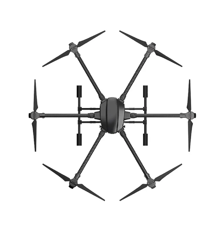
EFT 6120 Multifunction Surveillance Drone Frame
Heavy-duty 6-arm frame with folding design, ideal for carrying LiDAR sensors and survey payloads. Carbon fibre construction with dedicated sensor bays.
5. Flight Controller & Autopilot Setup
For survey-grade work, only ArduCopter (on a Pixhawk-class FC) or PX4 should be considered. Both support:
- Auto missions with pre-programmed waypoints
- Terrain following (critical for hilly surveys)
- MAVLink telemetry for real-time monitoring
- Loiter and Position Hold with centimetre-level RTK lock
Mount the FC on the anti-vibration standoffs and orient it precisely — even a 2° roll offset will degrade your point cloud accuracy. Use Mission Planner’s compass calibration wizard on-site, not in the workshop, to avoid magnetic interference from nearby buildings.

Anti-Vibration Shock Absorber for APM/KK/MWC/PixHawk
Silicone vibration damping mount that protects your flight controller from motor noise. Essential for accurate IMU readings during survey flights.
6. Choosing and Mounting the LiDAR Sensor
The LiDAR sensor is the heart of your mapping payload. For budget builds, the TFMini Plus or TF02-Pro (single-beam) works well for altitude hold and basic surface profiling. For actual 3D point cloud capture, you need a spinning or solid-state multi-beam LiDAR:
- Livox Mid-40 / Avia: Excellent range (260m), irregular scan pattern but great coverage. ~₹1.5–2.5 lakh.
- Ouster OS0-32: 32-channel, 50m range, IP67. Good for short-range dense mapping. ~₹2–3 lakh.
- RPLIDAR A3: Budget option, 25m, 360°, good for indoor/small area mapping. ~₹15,000.
Mount the LiDAR on a dedicated vibration-isolated plate below the drone, pointed downward. Ensure the sensor’s extrinsic calibration (position and orientation relative to the IMU) is precisely measured — errors here propagate directly into your point cloud.
7. GPS / RTK Integration
Standard GPS gives 3–5m accuracy — completely unusable for professional surveys. RTK (Real-Time Kinematic) GPS brings this down to 1–3 cm. In India, you have two options:
- Own base station: Set up a ground-based RTK receiver (Emlid RS2 or Here+ base) at a known survey point, broadcast corrections over your telemetry radio to the drone.
- NTRIP (network corrections): Use India’s NavIC/CORS network or private NTRIP services via a 4G connection on the drone’s companion computer.

25x25x8mm 28dB High Gain Ceramic Active GPS Antenna
High-sensitivity ceramic GPS antenna for NEO-6M, NEO-7M, and NEO-8M modules. Improves satellite lock quality critical for survey missions.
8. Telemetry & Ground Control Station
A reliable two-way telemetry link between the drone and your laptop running Mission Planner is non-negotiable for survey operations. The 915 MHz band is preferred in India as it offers better range and obstacle penetration than 433 MHz in open terrain. You need:
- Telemetry radio pair (air module + ground module)
- Laptop or ruggedised tablet with Mission Planner
- Yagi/directional antenna for extended range (>1 km)

3DR 100mW Radio Telemetry 915MHz for APM PX4 Pixhawk
Reliable 915 MHz telemetry radio pair for ArduCopter and PX4 flight controllers. Provides real-time MAVLink data up to 1+ km range.

2.4GHz Yagi-UDA Drone Signal Booster
Directional Yagi antenna booster to extend your drone’s control and telemetry range during survey missions over large areas.
9. Power System: Motors, ESCs & Battery
Survey drones carry heavy payloads and fly for extended durations. Motor selection must prioritise efficiency over raw thrust. For a 600–800mm frame with a 500g LiDAR payload, target a 2:1 or better thrust-to-weight ratio at hover. Recommended motors: 4114 320KV (15-inch props) or 5010 340KV (18-inch props) on 6S LiPo. The power distribution board should handle peak current cleanly.

100A Multirotor ESC Power Distribution Battery Board
Handles up to 100A continuous current for large quadcopter builds. Clean power distribution to motors and avionics with multiple output pads.
10. Software Configuration: ArduCopter & Mission Planner
After hardware assembly, configure ArduCopter with these survey-critical parameters:
- EKF3 enabled: Better vibration rejection and faster recovery from GPS glitches.
- WPNAV_SPEED: 5–8 m/s for dense scans (slower = more LiDAR points per metre).
- TERRAIN_ENABLE = 1: Download SRTM terrain data and enable terrain following.
- RTK GPS parameter: GPS_TYPE = 17 (UAVCAN/DroneCAN for Here3), 9 (RTK external) for Emlid.
- PRE_ARM_CHECK: Enable all checks; never fly a survey without GPS 3D fix + RTK float or fix status.
11. Flight Planning for LiDAR Surveys
In Mission Planner’s Survey (Grid) mode, set these parameters for typical terrain surveys:
- Altitude: 60–100m AGL for general surveys. Lower for detailed models (20–40m).
- Sidelap: 30–50% for LiDAR (vs 70% for photogrammetry).
- Speed: 6 m/s for most LiDARs (check sensor’s scan rate and line density requirements).
- Flight lines: Orient perpendicular to slope gradient for hilly terrain.
- Cross flights: Optional second pass at 90° dramatically improves point density and reduces shadow zones.
In India, plan your surveys during the 8–10 AM window (lower temperatures, calm winds, good satellite geometry). Avoid mid-afternoon (turbulent thermals) and monsoon conditions. Always conduct a site reconnaissance visit before the survey day.
12. Point Cloud Processing Workflow
Post-flight processing converts raw LiDAR data + IMU + GPS logs into usable maps:
- Time synchronisation: Align LiDAR timestamps with GNSS/IMU using PPS signal.
- SBET generation: Process raw IMU + RTK data with software like Inertial Explorer or open-source RTKLIB to generate a Smoothed Best Estimate Trajectory.
- Point cloud generation: Feed SBET + LiDAR data into LiDARMill, CloudCompare, or vendor-specific software (Livox Viewer).
- Ground filtering: Apply Cloth Simulation Filter (CSF) or Progressive Morphological Filter to classify ground vs non-ground points.
- DEM/DSM generation: Export to LAStools, PDAL, or QGIS for final raster products.
- Accuracy validation: Compare against ground control points (GCPs) — target ±5cm vertical RMSE for professional surveys.
13. Indian Drone Regulations (DGCA)
Operating a LiDAR survey drone in India is subject to the Drone Rules 2021 and the Digital Sky Platform. Key requirements:
- Drone must be registered on the Digital Sky Portal (UIN required).
- Pilot must hold a Remote Pilot Certificate (RPC) — written exam + practical test via DGCA-approved RPTO.
- Commercial survey operations require a Remote Pilot Organisation (RPO) certificate.
- Most survey areas require prior Permission for flight through the Digital Sky portal (Green zones are generally free; Yellow and Red zones need explicit approval).
- For surveys in border states (J&K, Ladakh, Northeast) — additional MHA clearance is mandatory.
14. Pro Tips for Survey Accuracy
- Always perform a boresight calibration flight before the actual survey to measure LiDAR-IMU angular offsets.
- Place Ground Control Points (GCPs) with retro-reflective targets — LiDAR returns bright hits from retro-reflectors.
- Use a sun compass or magnetic declination correction — India’s declination varies from -0.5° in Kanyakumari to +2° in Leh.
- Keep the battery above 30% — voltage sag at low charge affects the BEC output and can cause GPS glitches.
- Log all raw data locally (microSD on companion computer) — telemetry-only recording is insufficient for professional deliverables.

110cm Fast-Fold Landing Pad / Helipad for Drones
Large 110cm diameter landing pad ideal for survey drones. High-visibility markings and fast-fold design for field deployment.
FAQ: FPV LiDAR Mapping Drone
How much does it cost to build a LiDAR mapping drone in India?
A basic LiDAR survey drone using an RPLIDAR A3 sensor can be built for approximately ₹80,000–1,00,000. A professional build with Livox Mid-40 and RTK GPS will cost ₹3,00,000–5,00,000. Commercial equivalents like the DJI Zenmuse L2 cost upwards of ₹8,00,000.
Do I need a licence to fly a LiDAR drone in India?
Yes. If the drone weighs over 250g (which virtually all LiDAR drones do), you need a Remote Pilot Certificate (RPC) from DGCA. Commercial survey work additionally requires a Remote Pilot Organisation (RPO) certificate for the operating company.
What accuracy can I expect from a DIY LiDAR drone?
With RTK GPS and a quality LiDAR (Livox / Ouster), DIY builds typically achieve ±3–8 cm vertical accuracy and ±5–10 cm horizontal accuracy — suitable for most topographic and engineering surveys.
Can LiDAR drones be used for agriculture in India?
Absolutely. LiDAR is used for precise contour irrigation planning, crop height measurement, and detection of drainage patterns. Under PM Gati Shakti and Digital India land digitisation programmes, LiDAR survey drones are increasingly used by state governments.
Which flight controller software is best for LiDAR surveys?
ArduCopter with Mission Planner is the most widely used open-source option for survey drones in India. PX4 with QGroundControl is equally capable. Both support RTK GPS, terrain following, and pre-programmed survey grid missions.
Ready to Build Your LiDAR Survey Drone?
Zbotic stocks all the drone building components you need — from frames and flight controllers to propellers, ESCs, and telemetry radios. All products are sourced, quality-checked, and shipped from India with fast delivery across the country.


Add comment