
Drone LiDAR Sensor Guide: Obstacle Avoidance and Precision Mapping
LiDAR — Light Detection and Ranging — is one of the most transformative technologies in modern drone applications. From enabling autonomous obstacle avoidance in agricultural sprayers flying between mango trees in Maharashtra, to generating millimetre-precision terrain maps for infrastructure projects in Himalayan states, LiDAR gives drones a way to “see” their environment that cameras simply cannot match. This comprehensive guide explains how drone LiDAR works, how to integrate it with ArduPilot, the best sensors for Indian conditions, and the diverse use cases emerging across India’s drone economy.
1. How Drone LiDAR Works
LiDAR operates on a beautifully simple principle: fire a laser pulse, measure precisely how long it takes for the reflection to return, and calculate distance using the speed of light. At its core:
Distance = (Speed of Light × Time of Flight) / 2
Modern drone LiDAR systems fire thousands to millions of pulses per second. By combining these distance measurements with the drone’s known position (from GPS and IMU) and orientation (from the IMU), the sensor builds up a dense 3D point cloud representation of the terrain and objects below and around the drone.
Key LiDAR Components
- Laser emitter: Typically operates at 905nm (near-infrared) or 1550nm wavelengths. 1550nm is eye-safe at higher powers, enabling more powerful sensors for longer range.
- Receiver/detector: Captures the reflected photons and converts them to electrical signals.
- Scanner mechanism: Rotates or oscillates the laser beam to cover a 2D or 3D scan area. Mechanical spinning LiDAR covers 360°; solid-state LiDAR uses beam-steering for a fixed field of view.
- Processing unit: Computes distances from time-of-flight measurements and outputs point cloud data, typically over Ethernet, USB, or serial interface.
- IMU integration: A high-quality IMU inside the LiDAR unit records sensor orientation at microsecond resolution for motion compensation during point cloud generation.
Return Types
Sophisticated LiDAR systems record multiple returns per laser pulse. A single pulse fired at a tree canopy might record a first return from the top leaves, then a second return from a lower branch, and finally a last return from the ground beneath. This multi-return capability is what allows LiDAR to penetrate vegetation — invaluable for mapping terrain under India’s dense forest cover or tall crop canopies.
2. LiDAR vs Camera: When to Use Each
Both LiDAR and photogrammetry (camera-based mapping) create 3D terrain data. Understanding when to use each saves significant cost and time.
| Factor | LiDAR | Camera/Photogrammetry |
|---|---|---|
| Vegetation penetration | Excellent (multi-return) | Poor — cannot see under canopy |
| Works in low light / night | Yes | No (needs daylight) |
| Vertical accuracy | 1–5cm absolute | 3–10cm with GCPs |
| Visual output (RGB) | No (requires separate camera) | Yes — full-colour orthomosaic |
| Cost | High (₹2–20 lakh for sensor) | Low (camera cost only) |
| Processing time | Fast (direct point cloud) | Slow (SfM reconstruction) |
Choose LiDAR when: You need to map under vegetation (forest DTMs, orchard canopy mapping), work in low-light conditions, need the highest possible vertical accuracy without GCPs, or are doing urban canyon mapping where dense building shadows would ruin photogrammetry results.
Choose Camera when: You need full-colour orthomosaic imagery, budget is limited, working in open terrain without vegetation, or producing survey deliverables that need visual context (land records, urban planning).
3. Types of Drone LiDAR Sensors
By Scanning Mechanism
Mechanical Spinning LiDAR
The classic LiDAR design — a spinning head with multiple laser/detector pairs provides 360° horizontal coverage. Examples: Velodyne VLP-16 (16-channel), Ouster OS0-32. These are heavy (600g–2kg) and power-hungry (8–18W) but provide excellent coverage. Suitable for large hexacopter and octocopter mapping platforms.
Solid-State LiDAR (Flash LiDAR)
No moving parts — the laser illuminates the entire field of view simultaneously. Much lighter and more vibration-resistant than spinning LiDAR. Limited field of view (typically 70°x70°) but sufficient for downward-facing mapping. Examples: Livox Mid-40, Livox Avia. Price: ₹1–4 lakh. Very popular for drone obstacle avoidance.
MEMS LiDAR
Uses micro-mirror arrays to steer the laser beam. Very compact and lightweight (<200g). Lower cost than spinning LiDAR. Examples: Intel RealSense L515 (discontinued), newer automotive MEMS sensors being adopted for drones. The technology is evolving rapidly.
By Application Purpose
Rangefinder LiDAR (1D / Single Beam)
Simplest form — measures distance in one direction only (typically downward). Used for precise altitude hold over varying terrain. ArduPilot uses these to maintain constant AGL (Above Ground Level) altitude during survey flights over hilly terrain. Examples: Lightware SF11/C, Benewake TFMini, Garmin LIDAR-Lite v3.
These are affordable (₹2,000–15,000) and easy to integrate. They dramatically improve agricultural drone accuracy when spraying over undulating farmland.
2D Scanning LiDAR
Scans a 2D plane (like a slice through the environment). Mounted horizontally, provides 360° obstacle detection in a horizontal plane. Examples: RPLIDAR A1/A2/A3 (made by Slamtec, very popular for robotics and drones). ArduPilot supports RPLiDAR for proximity sensing. Price: ₹8,000–25,000.
3D Mapping LiDAR
Full 3D point cloud capability — the complete sensor system for professional mapping. Multiple spinning channels or solid-state beam steering. Examples: Livox Mid-360, DJI Zenmuse L1. These typically cost ₹2–20 lakh. Requires a powerful companion computer (Nvidia Jetson, Raspberry Pi 4) for real-time processing on the drone.
4. Obstacle Avoidance with LiDAR
Obstacle avoidance is one of the most practically important applications for drone LiDAR in India. Agricultural drones flying over fields lined with trees, power lines, and irrigation pipes need robust obstacle detection to prevent crashes and protect crops.
Types of Obstacle Detection
Downward Facing (Terrain Following)
A single-beam rangefinder LiDAR pointing straight down enables terrain following. ArduPilot reads the distance and maintains a constant height above the actual ground surface. Critical for agricultural spraying — if you fly at constant GPS altitude and the terrain rises, the boom gets too close to the crop. Terrain following at 2–3m AGL keeps spray coverage consistent.
Forward-Facing Obstacle Avoidance
A 2D LiDAR mounted to scan forward (or sometimes all directions) detects obstacles in the drone’s flight path. ArduPilot’s Object Avoidance feature uses proximity sensor data to stop the drone before it hits an obstacle, or to plan a path around it using BendyRuler (simple avoidance) or Dijkstra’s path planner (complex avoidance).
360° Proximity Detection
A horizontally spinning 2D LiDAR (like RPLiDAR) mounted on top of the drone provides full 360° proximity sensing. Any obstacle within 10m triggers a stop or avoidance maneuver. This is the most comprehensive approach for flying in cluttered environments like between buildings or inside greenhouses.
Limitation: Rain and Dust in India
Indian agricultural operations often occur in dusty conditions (Rajasthan, Gujarat) or during the monsoon season when rain is common. Most LiDAR systems perform poorly in heavy rain or thick dust — water droplets and dust particles reflect laser pulses and generate false returns (ghost obstacles). Check the IP rating and operational conditions of any LiDAR system before deploying in Indian field conditions. Benewake TFMini and similar industrial rangefinders with IP ratings are better suited to Indian agricultural environments than research-grade sensors.
5. ArduPilot LiDAR Integration Guide
ArduPilot has excellent built-in support for LiDAR sensors, both for rangefinding (altitude) and proximity sensing (obstacle avoidance). Here is how to configure the most common setups.
Rangefinder Integration (Serial / I2C)
For downward-facing altitude LiDAR (e.g., Benewake TFMini, Lightware SF11):
- Connect sensor TX → FC UART RX, Sensor RX → FC UART TX, 5V and GND
- In Mission Planner, set the appropriate serial port:
SERIALx_PROTOCOL = 9(Rangefinder) - Set
RNGFND1_TYPEto match your sensor (e.g., 20 for TFMini, 8 for Lightware i2c) - Set
RNGFND1_MIN_CMandRNGFND1_MAX_CMto sensor specs - Set
RNGFND1_ORIENT = 25(downward facing) - Enable terrain following:
TERRAIN_ENABLE = 1 - In Mission Planner, create waypoints with “Terrain” altitude type instead of “Relative”
RPLiDAR A2 Proximity Sensor Integration
For 360° obstacle avoidance with RPLiDAR:
- Connect RPLiDAR via USB-to-serial adapter to FC UART port
- Set serial port:
SERIALx_PROTOCOL = 11(Proximity) - Set
PRX_TYPE = 5(RPLiDAR) - Set
AVOID_ENABLE = 7(enable avoidance in all modes) - Set
AVOID_MARGIN = 2(2m margin from obstacles) - Enable BendyRuler:
OA_TYPE = 1
Telemetry for LiDAR Status
Monitor LiDAR status in Mission Planner’s Status panel. Look for sonarrange (rangefinder distance) and check the proximity indicator for proximity sensor data. Always test obstacle avoidance in a controlled environment before field deployment.

3DR 100mW Radio Telemetry 915MHz For APM PX4 Pixhawk
Essential telemetry for monitoring ArduPilot LiDAR integration in real time. View rangefinder data, obstacle avoidance status, and terrain-following altitude in Mission Planner from the ground during test flights.
View on Zbotic6. Mapping with LiDAR: Point Clouds and DTMs
When LiDAR is used for mapping (not just obstacle avoidance), the workflow involves capturing the raw point cloud and then processing it into usable geospatial products.
The LiDAR Mapping Workflow
- Data capture: Fly the mapping mission with LiDAR system active. The sensor logs: timestamps, distance measurements, scan angles, and the drone’s IMU/GPS trajectory.
- GNSS/IMU post-processing (PPK): For survey-grade accuracy, post-process the GPS trajectory using CORS (Continuously Operating Reference Station) corrections available from Survey of India’s CORS network. This gives centimetre-level drone position for every LiDAR return.
- Point cloud generation: Software like LiDAR360, TerraSolid, or the open-source CloudCompare fuses the LiDAR ranges with the corrected drone trajectory to produce a geo-referenced 3D point cloud in LAS/LAZ format.
- Classification: Automated classification separates ground returns from vegetation, buildings, and other above-ground features. This is the step where LiDAR’s multi-return capability proves its worth — ground returns are isolated even under dense canopy.
- DTM generation: Digital Terrain Model (ground surface) is generated by interpolating the classified ground returns. Resolution: typically 10–50cm from drone-mounted LiDAR.
- Deliverables: DSM (including vegetation and buildings), DTM (bare earth), intensity images (like a greyscale photo from reflected laser intensity), and contour maps.
GPS for LiDAR Integration
Precise GPS is critical for accurate LiDAR mapping. A ceramic active GPS antenna with high gain ensures the GPS module gets the best possible satellite lock, minimising position error in the LiDAR point cloud.

28dB High Gain Ceramic Active GPS Antenna (NEO-6M/7M/8M)
A high-gain ceramic patch GPS antenna with 28dB LNA amplification. Provides superior satellite lock in challenging conditions — essential for LiDAR mapping platforms where GPS accuracy directly translates to point cloud accuracy.
View on Zbotic7. Sensor and Hardware Recommendations
Here is a practical guide to sensors and support hardware available to Indian drone builders.
Budget Obstacle Avoidance Setup (₹5,000–20,000)
For terrain following on agricultural drones: Benewake TFMini Plus (12m range, IP65, serial interface, ₹3,000–6,000). For proximity sensing: Slamtec RPLIDAR A2 (8m range, 4000 samples/sec, ₹8,000–15,000). Both integrate directly with ArduPilot.
Professional Mapping LiDAR (₹1–5 lakh)
Livox Mid-360: Compact solid-state LiDAR, 360° horizontal, 59° vertical FOV, 200m range, <350g, USB output. Excellent for mid-size hexacopters. Benewake CE30-D: Forward-facing solid-state obstacle avoidance sensor, 50° x 25° FOV, 7m range, very compact.
Survey-Grade LiDAR Systems (₹10–25 lakh)
Complete systems like the GreenValley LiAir series or DJI Zenmuse L2 include the LiDAR sensor, integrated IMU, and post-processing software. These are used by professional survey companies across India for infrastructure, forestry, and cadastral mapping.
Supporting Hardware
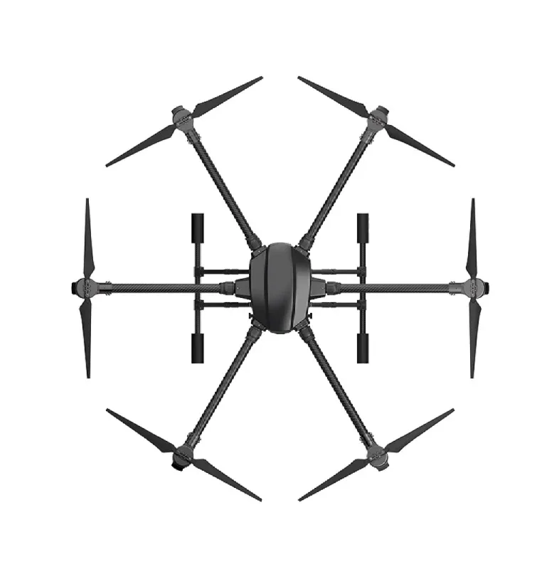
EFT 6120 Multifunction Drone Frame
A hexacopter frame with sufficient payload capacity for professional LiDAR systems. The wide platform provides mounting space for LiDAR, companion computer, and battery while maintaining stable flight for accurate point cloud data collection.
View on Zbotic
T-Motor A10-KV120-CCW Modular Propulsion System
High-efficiency T-Motor propulsion units for heavy-lift platforms. The modular design simplifies maintenance in the field — critical for professional mapping operations where downtime costs money. KV120 rating with 10-inch props provides excellent efficiency for long LiDAR mapping missions.
View on Zbotic8. Use Cases Specific to India
Forest Inventory and Carbon Credit Mapping
India’s forest departments across Uttarakhand, Himachal Pradesh, and the Western Ghats are increasingly using drone LiDAR for forest inventory. LiDAR measures tree height, canopy density, and basal area — all critical for calculating above-ground biomass and carbon stock. This data supports India’s international climate commitments under the Paris Agreement and unlocks carbon credit markets for forest protection projects.
Power Line Inspection
India’s power grid extends over 4 million km of transmission and distribution lines. LiDAR-equipped drones can fly alongside power lines, automatically measuring the sag of the line, detecting encroachment of vegetation within the safety corridor, and identifying broken insulators or damaged hardware. This replaces dangerous manual inspection by linemen at height.
Railway Track Inspection
Indian Railways is piloting drone LiDAR for track geometry inspection — measuring rail gauge, cant (superelevation), and ballast condition along the track. A drone can cover 10km of track in one flight, compared to manual inspection which covers 1–2km per day per inspector team.
Coastal Erosion Monitoring
India’s 7,500km coastline faces significant erosion pressure. LiDAR surveys repeated at 6-month intervals precisely quantify beach erosion and accretion, providing data for coastal management authorities in states like Kerala, Odisha, and Tamil Nadu where coastal communities are most vulnerable.
Archaeological Survey
LiDAR has revealed hidden archaeological structures beneath jungle vegetation globally. In India, sites beneath forest cover in Rajasthan, Madhya Pradesh, and the Northeast remain unexplored. Drone LiDAR offers a non-invasive way to detect ancient earthworks, moats, and building foundations beneath forest canopy without disturbing the sites.
9. Challenges and Limitations
Cost Barrier
Professional 3D mapping LiDAR systems cost ₹5–25 lakh — accessible to survey companies but beyond most hobbyists. The good news: rangefinder LiDAR for terrain following starts at under ₹5,000, and prices across all categories are falling rapidly.
Data Volume
LiDAR generates enormous amounts of data. A 30-minute Livox Mid-360 scan generates 10–50GB of raw data. Processing this requires a capable workstation (32GB+ RAM, good GPU) and specialist software. Budget for computing infrastructure alongside the sensor.
DGCA Payload Certification
Adding an external LiDAR payload changes your drone’s configuration from its DGCA-registered state. Under current Indian drone rules, payload swaps on registered drones may require updated documentation. Work with your drone’s manufacturer to understand the implications for your UIN registration before deploying LiDAR commercially.
Sun Angle Effects
Some LiDAR systems (particularly those using 905nm wavelength) experience noise in bright sunlight — the sun’s radiation at this wavelength competes with the sensor’s own laser returns. Flying in the morning or evening, or using systems rated for daytime operation, mitigates this. In India’s intense summer sun (Rajasthan, AP reaching 45°C+), this is a real concern.
10. Frequently Asked Questions
A: DJI’s closed ecosystem makes adding third-party LiDAR difficult on most models. DJI’s own Zenmuse L1/L2 sensors only work with DJI Matrice platforms. For custom LiDAR integration with full hardware control, ArduPilot on a custom build is the recommended path. The Pixhawk-based platform gives you full access to proximity sensor integration through Mission Planner.
A: Ultrasonic (sonar) sensors use sound waves and work well from 0.2–7m range. They are cheap (₹100–500) but affected by wind noise, motor vibrations, and reflective surfaces (water, glass). LiDAR rangefinders use laser light — faster response, much longer range (30–120m), unaffected by motor noise, and work reliably on all surface types. For any serious flying application, LiDAR rangefinder is worth the higher cost (₹3,000–15,000).
A: Survey of India (SOI) and state survey departments are progressively accepting drone LiDAR data for certain applications. The SVAMITVA scheme uses drone data (primarily photogrammetry) officially. For LiDAR specifically, acceptance varies by state and application. Revenue department cadastral surveys typically still require traditional survey methods or photogrammetry with GCPs. LiDAR is more accepted for infrastructure, forestry, and engineering applications. Always check with the specific agency before conducting surveys with deliverable expectations.
A: When a rangefinder is configured and TERRAIN_ENABLE=1 is set, ArduPilot uses the LiDAR reading to determine the actual ground height. In Auto mode, when mission waypoints are set with “Terrain” altitude type, the flight controller adds the LiDAR-measured ground distance to the waypoint’s specified AGL altitude, and adjusts the GPS target altitude accordingly. The result is the drone maintaining a constant height above the actual ground surface even over hills and valleys.
A: Standard 905nm LiDAR used in drones does not penetrate water — it reflects off the water surface. Bathymetric LiDAR using 532nm (green) wavelengths can penetrate water up to 50m depth, but these are very expensive specialist systems used for coastal/river mapping. For standard drone LiDAR mapping in India, rivers, ponds, and lakes will appear as flat surfaces in the point cloud, which is still useful for boundary mapping and waterway planning.
Build Your LiDAR-Equipped Drone Platform
Zbotic stocks Pixhawk flight controllers, GPS modules, telemetry systems, and heavy-lift drone frames to build your professional LiDAR mapping rig. Get expert guidance and pan-India delivery.
Shop Drone Components


Add comment