
Table of Contents
- Overview: What Are These Satellite Systems?
- GPS: The American Pioneer
- GLONASS: Russia’s Answer to GPS
- Galileo: Europe’s Precision System
- BeiDou: China’s Global Network
- Head-to-Head Comparison Table
- Accuracy: Which System Is Most Precise?
- Coverage and Availability
- Why Multi-GNSS Receivers Beat Any Single System
- Choosing a GNSS Module for Arduino Projects
- Application-Specific Recommendations
- Frequently Asked Questions
Open your phone’s settings and look at the location information — you will likely see it using GPS, GLONASS, and Galileo simultaneously. But what exactly are these systems, how do they differ, and does it matter which one (or which combination) your device uses? For electronics makers building GPS-enabled projects, these questions are directly relevant to choosing the right module.
This guide gives a thorough, technically accurate comparison of the three major satellite navigation systems — GPS, GLONASS, and Galileo — plus China’s BeiDou, and explains why modern receivers almost universally combine all of them for the best results.
Overview: What Are These Satellite Systems?
All of these systems belong to the family called GNSS: Global Navigation Satellite Systems. They all work on the same fundamental principle:
- A constellation of satellites orbits Earth, each broadcasting a precise timestamp along with its orbital position
- A receiver on the ground captures signals from multiple satellites simultaneously
- By measuring the time delay of each signal (and therefore the distance to each satellite), the receiver can triangulate its position in three dimensions
- A minimum of 4 satellites are needed: 3 for X/Y/Z position, and a 4th to correct for receiver clock error
The differences between systems lie in orbital configuration, signal frequencies, signal structure, number of satellites, and who controls them — which collectively affect accuracy, availability in challenging environments, and resistance to interference and spoofing.
GPS: The American Pioneer
The Global Positioning System (GPS) is operated by the United States Space Force (previously Air Force). It was the world’s first fully operational global navigation satellite system, declared fully operational in 1995 after decades of development. GPS has been so dominant that “GPS” has become the generic public term for satellite navigation, even when referring to other systems.
Constellation: GPS uses 31 operational satellites (24 required for full coverage, with 7 active spares) in medium Earth orbit (MEO) at 20,200 km altitude, arranged in 6 orbital planes inclined at 55° to the equator. Each satellite completes two orbits per day.
Signal frequencies:
- L1 (1575.42 MHz): Primary civilian signal. Uses C/A (Coarse/Acquisition) code available to all receivers, plus L1C (a modernised civilian signal on newer GPS III satellites)
- L2 (1227.60 MHz): Originally military-only; now the L2C signal is available to civilian receivers with compatible hardware
- L5 (1176.45 MHz): Newest civil signal, high-power, wide bandwidth — greatly improves accuracy in urban canyons and provides the “Safety of Life” signal for aviation
Accuracy:
- Standard Positioning Service (SPS, L1 C/A): 3–5 metres horizontal accuracy
- With satellite-based augmentation (SBAS like GAGAN in India): 1–3 metres
- Dual-frequency (L1 + L5): sub-metre with modern chipsets
- RTK (Real-Time Kinematic) corrections: centimetre-level
Strengths: Largest ecosystem, most receivers, best global civilian support infrastructure, extensive augmentation network (WAAS in North America, GAGAN over India, EGNOS in Europe).
Weaknesses: Originally designed with an intentional degradation called Selective Availability (SA) that added error for civilian users — this was disabled in 2000 but the history shaped early perceptions. Under control of a single nation (USA), though civilian signals are guaranteed under policy.
GLONASS: Russia’s Answer to GPS
GLONASS (Globalnaya Navigatsionnaya Sputnikovaya Sistema) is Russia’s counterpart to GPS, operated by the Russian Aerospace Defence Forces. It was first operational in 1995, fell into partial disrepair after the collapse of the Soviet Union, and was fully restored to global coverage in 2011 under strong government investment.
Constellation: 24 satellites in MEO at 19,100 km altitude, in 3 orbital planes inclined at 64.8° to the equator. The higher inclination (compared to GPS’s 55°) is the key architectural difference.
Signal frequencies: GLONASS uses a unique approach called FDMA (Frequency Division Multiple Access) — each satellite broadcasts on a slightly different frequency, which helps receivers distinguish satellites but complicates receiver design. Modern GLONASS-M and GLONASS-K satellites also support CDMA signals (like GPS) on L3 for better compatibility.
- L1OF (1598.0625 – 1605.375 MHz): Open civilian signal
- L2OF (1242.9375 – 1248.625 MHz): Open civilian signal
- L3 (1202.025 MHz): CDMA civil signal on GLONASS-K satellites
Accuracy: GLONASS standard civil accuracy is 2.8–7.38 metres horizontal — comparable to GPS. GLONASS-K modernisation brings dual-frequency capability and improved accuracy.
Key strength: High-latitude coverage. The 64.8° orbital inclination means GLONASS satellites pass over higher latitudes (Russia, Scandinavia, Canada, Alaska) at better elevations than GPS. In cities above 60° north, GLONASS often provides more satellites in view than GPS — which directly translates to better accuracy and availability.
Weaknesses: The FDMA signal structure requires more complex receiver hardware. Historically had more satellite outages during the 2000s when Russia lacked resources for timely replacements. Geopolitical considerations: controlled by Russia, though civil signals are currently guaranteed by policy.
Galileo: Europe’s Precision System
Galileo is the European Union’s GNSS, operated by the European Union Agency for the Space Programme (EUSPA) and the European Space Agency (ESA). It achieved Initial Operational Capability in 2016 and Full Operational Capability declaration in 2024 with 30 satellites (28 active, 2 spares) in MEO at 23,222 km altitude — the highest altitude of the three main systems.
Galileo was designed entirely for civilian use, without a military origin, which shapes its architecture in important ways. It was the first system to officially promise accuracy guarantees in its legal framework, and it offers the highest publicly documented civilian accuracy of the three major systems.
Signal frequencies:
- E1 (1575.42 MHz): Open Service (OS) signal — notably on the same frequency as GPS L1, allowing GPS/Galileo dual-use receivers to share antenna hardware and processing
- E5a (1176.45 MHz): Same as GPS L5 — again, designed for cross-system compatibility
- E5b (1207.14 MHz): Additional open signal, enables excellent ionospheric correction when combined with E1
- E6 (1278.75 MHz): Commercial Service (CS) and High Accuracy Service (HAS) — Galileo’s free high-accuracy signal
Accuracy — Galileo’s standout advantage:
- Open Service (E1 single-frequency): 1–3 metres
- Dual-frequency OS (E1 + E5a): sub-metre, often reported at 20–50 cm
- High Accuracy Service (HAS, via E6): 20 cm horizontal accuracy — FREE, without needing ground correction stations, using only satellite signals. This launched in 2023 and is a genuine breakthrough.
- With PPP (Precise Point Positioning): centimetre-level
Orbital altitude advantage: At 23,222 km, Galileo satellites are higher than GPS (20,200 km) or GLONASS (19,100 km). Higher altitude means more of Earth’s surface is visible from each satellite, contributing to better geometry (DOP) in certain regions.
Weaknesses: Newer system — full operational capability declared later than GPS and GLONASS, so the ecosystem of modules and antennas is still growing but catching up rapidly. Had some high-profile outage events during early deployment (2019 outage lasted several days).
BeiDou: China’s Global Network
No GNSS comparison is complete without mentioning BeiDou (BDS), China’s satellite navigation system. BeiDou-3 completed its global constellation in June 2020 with 35 satellites in a mixed orbit configuration (MEO + IGSO + GEO). It now rivals GPS in satellite count and offers competitive accuracy.
BeiDou is heavily optimised for the Asia-Pacific region (where it has additional IGSO and GEO satellites providing enhanced coverage) and is mandatory in certain Chinese government applications. Many modern GNSS modules sold globally now support BeiDou alongside GPS, GLONASS, and Galileo.
Accuracy: 1.5–3 metres with single-frequency; sub-metre with dual-frequency on B1I/B2a. BeiDou’s short message communication service (a two-way messaging capability built into the satellite signals) is unique and has no equivalent in other GNSS systems.
Head-to-Head Comparison Table
| Feature | GPS | GLONASS | Galileo | BeiDou |
|---|---|---|---|---|
| Operator | USA | Russia | EU / ESA | China |
| Active satellites | 31 | 24 | 28 | 35 |
| Orbital altitude | 20,200 km | 19,100 km | 23,222 km | Mixed |
| Inclination | 55° | 64.8° | 56° | 55° MEO |
| L1 / E1 freq. | 1575.42 MHz | 1598–1605 MHz | 1575.42 MHz | 1561.098 MHz |
| Signal type | CDMA | FDMA / CDMA | CDMA | CDMA |
| Best civil accuracy | 0.3 m (dual-freq) | 1.4 m (dual-freq) | 0.2 m (HAS) | 0.5 m (dual-freq) |
| High-accuracy service | Via SBAS (GAGAN) | No | Yes (HAS, free) | PPP-B2b (Asia) |
| Full ops since | 1995 | 2011 | 2024 | 2020 |
Accuracy: Which System Is Most Precise?
Accuracy depends heavily on the signal frequency, receiver quality, and environmental conditions. Here is how the systems rank:
1. Galileo HAS (winner for free high accuracy)
Galileo’s High Accuracy Service broadcasts free corrections on the E6 signal that bring horizontal accuracy to approximately 20 cm without ground stations. No other system offers this for free globally using only satellite signals. As of 2024, this is the most accurate freely available civilian GNSS signal in the world.
2. GPS + SBAS (GAGAN for India)
India’s GAGAN (GPS Aided GEO Augmented Navigation) is an SBAS that provides integrity and differential corrections for aviation and land users. Combined with L5, GPS achieves sub-50 cm accuracy in the GAGAN coverage area, which covers all of India and extends to the Indian Ocean.
3. GPS dual-frequency (L1 + L5)
Dual-frequency receivers eliminate most of the ionospheric delay error (the largest source of GPS error in normal conditions). The iPhone 15, recent Samsung Galaxy devices, and Pixel phones all support dual-frequency GPS + Galileo, achieving 30 cm – 1 m accuracy in open conditions.
4. Single-frequency GPS or GLONASS alone
Horizontal accuracy of 2–5 metres under good conditions. This is what older navigation devices and basic Arduino GPS modules achieve.
The ionospheric effect: The ionosphere (a charged layer of the atmosphere at 60–1000 km altitude) bends and delays GPS signals. This is the largest error source in GNSS positioning. Dual-frequency receivers measure this delay directly (different frequencies are delayed differently) and correct for it. Single-frequency receivers rely on model-based corrections that are less accurate, especially in equatorial regions like India where ionospheric activity is high.
Coverage and Availability
All four systems provide global coverage, but the geometry of satellite availability varies by location:
India and South Asia: GPS and Galileo provide good coverage. GAGAN augments GPS with higher accuracy. BeiDou has good coverage due to its GEO and IGSO satellites over Asia. India also has NavIC — its own regional satellite navigation system (formerly IRNSS) with 7 satellites covering India and surrounding regions — which is increasingly included in Indian smartphone chipsets.
High latitudes (above 60° N): GLONASS’s 64.8° orbital inclination makes it significantly better here. In Helsinki, Oslo, or northern Canada, GLONASS provides more satellites at higher elevation angles than GPS, directly improving accuracy and reducing multipath errors.
Urban canyons: More satellites from more systems means better geometry even when many signals are blocked by buildings. A multi-constellation receiver in a dense city might see 30+ satellites, easily maintaining a fix despite half of them being blocked.
GNSS signal availability under different sky conditions:
- Open sky: All systems work equally well; typically 6–12 satellites visible per system
- Moderate urban: Multi-constellation critical; single system may struggle below 4 visible satellites
- Dense urban canyon: Only multi-constellation with good processing algorithms maintains reliable fix
- Indoor: No GNSS system works; alternatives like Wi-Fi positioning, BLE beacons, or dead reckoning are needed
Why Multi-GNSS Receivers Beat Any Single System
This is the most practically important insight in the entire comparison: no single GNSS system outperforms a well-implemented multi-constellation receiver. Here is why:
More satellites = better geometry (lower DOP): The Dilution of Precision (DOP) is a measure of how satellite geometry affects positioning accuracy. When satellites are spread evenly across the sky, DOP is low and accuracy is good. When satellites cluster together in one part of the sky (which happens inevitably with any single constellation), DOP worsens. Adding satellites from a second system fills the gaps and keeps DOP consistently low.
More satellites = better availability: In urban environments, buildings block individual signals. With 8 GPS satellites visible but 3 blocked by buildings, you have 5 usable — marginal. Add 6 GLONASS satellites with 2 blocked and 5 Galileo with 1 blocked, and you have 13 usable satellites — an excellent fix.
Redundancy and integrity monitoring: With many satellites, the receiver can detect and exclude outliers (faulty or spoofed signals) while maintaining a reliable fix. Aviation-grade GNSS uses this property (called RAIM — Receiver Autonomous Integrity Monitoring) for safety-critical navigation.
Reality check: Every modern smartphone (since roughly 2015) supports at least GPS + GLONASS. Since 2018–2020, most flagship phones support all four systems plus QZSS (Japan) and NavIC (India). For Arduino GPS module projects, modules supporting GPS + GLONASS are the baseline choice, with GPS + GLONASS + Galileo + BeiDou available in slightly more expensive options.

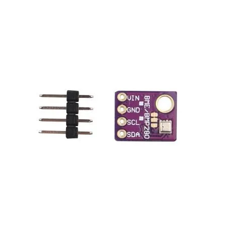
GY-BME280 Barometric Pressure Sensor
Complement your GPS tracker with barometric altitude data — BME280 provides altitude via pressure for GPS-denied indoor use.
Choosing a GNSS Module for Arduino Projects
For makers building GPS-enabled projects with Arduino, ESP32, or Raspberry Pi, the key module specifications to evaluate are:
Constellation support:
- GPS only: Basic and cheap (e.g. NEO-6M) — acceptable for low-accuracy tracking but avoid if you need reliable urban coverage
- GPS + GLONASS: Better availability, good value (e.g. u-blox M8N)
- GPS + GLONASS + Galileo + BeiDou: Best performance (e.g. u-blox M10, MediaTek MT3339 newer revisions)
Update rate: How many position fixes per second? Standard is 1 Hz (1 fix/second). For robotics or vehicle tracking, 5–10 Hz is much better. Most u-blox modules support 5 Hz or higher on multi-constellation mode.
Sensitivity: Measured in dBm, lower is better. Better sensitivity means the module maintains a fix in urban areas or under tree cover. Modern modules like u-blox M8 achieve -167 dBm tracking sensitivity.
Time-to-first-fix (TTFF): Cold start TTFF is how long it takes to get a first position fix from power-up with no cached data. Hot start (with recent almanac data cached) can be under 1 second. Cold start typically takes 30–60 seconds depending on signal conditions.
Interface: Most modules use UART (serial) with NMEA sentences as output — compatible with any Arduino serial port. Some modules also support I2C or SPI. The u-blox proprietary UBX binary protocol allows more precise configuration of the module.
Antenna: Patch antenna modules include a small built-in ceramic patch antenna (adequate for open-sky use). For better performance, use a module with an external antenna connector and connect an active GPS antenna with a ground plane.
GY-BME280-5V Temperature and Humidity Sensor
Add environmental logging to your GPS tracker — record temperature, humidity, and pressure alongside location data.
Application-Specific Recommendations
Hobbyist vehicle tracking / asset monitoring:
GPS + GLONASS module (NEO-M8N or equivalent). 2–5 m accuracy is sufficient. Cost: ₹500–₹1200 for a complete module with antenna.
Drone / UAV navigation:
GPS + GLONASS + BeiDou, 5–10 Hz update rate. Many drone flight controllers use u-blox M8N or M9N chipsets. The faster update rate is essential for control loop feedback.
Precision agriculture / surveying:
Dual-frequency GPS + Galileo with RTK corrections. RTK base station + rover setup achieves centimetre-level accuracy. This requires more expensive hardware (₹15,000+) but the Galileo HAS signal (once widely supported in modules) will eventually offer free sub-metre globally.
Hiking / outdoor recreation:
GPS + GLONASS (standard in most GPS watches and handheld units). Galileo is being added to newer devices. The combination ensures reliability in forests and mountains where satellite geometry can be challenging.
Indoor navigation:
GNSS does not work indoors. Use Wi-Fi positioning, Bluetooth beacons, UWB (Ultra-Wideband like u-blox EVK-VERA-W1), or optical methods instead.
Indian users specifically:
Look for modules supporting NavIC (IRNSS). NavIC offers improved availability and accuracy over India specifically. Qualcomm and MediaTek chipsets in newer smartphones support NavIC; dedicated NavIC modules are increasingly available for Arduino projects. NavIC combined with GPS provides excellent coverage and accuracy across the Indian subcontinent.
Frequently Asked Questions
Is GPS more accurate than GLONASS?
At mid-latitudes (where most of the world’s population lives), GPS L1 and GLONASS L1 single-frequency accuracy are comparable — both around 2–5 metres. Galileo single-frequency is slightly better (1–3 metres) by design. At high latitudes above 60° N, GLONASS is typically more accurate due to better satellite geometry from its higher orbital inclination. At low latitudes and in India, GPS with GAGAN augmentation can outperform GLONASS.
Can my phone use all three systems simultaneously?
Yes — if the chipset supports it. Most smartphones since 2018 use chipsets (Qualcomm Snapdragon 845+, MediaTek Helio G90+) that simultaneously track GPS, GLONASS, Galileo, and BeiDou. You can check your phone’s GNSS capability using apps like “GPS Test” or “GPSInfo” on Android, which show exactly which satellites are being tracked in real time.
Does Galileo work in India?
Yes. Galileo is a global system and all 28+ satellites are visible from India (not simultaneously, but in succession throughout the day, similar to GPS). Galileo’s E1 signal is on the same frequency as GPS L1, so GPS/Galileo dual-system receivers require no additional hardware beyond a GPS antenna. The HAS precision service (20 cm accuracy) is available globally including India.
Will GPS be shut down in a conflict?
The USA has committed by law (2018) not to degrade civilian GPS signals. However, the US military can jam or deny GPS in specific regions during military operations (as has happened in various conflict zones). This is why civilian aviation uses Galileo as a backup system in Europe — independent control diversifies risk. For consumer and hobbyist use, the practical risk of GPS denial is extremely low.
What is the difference between GNSS and GPS?
GPS is a specific American satellite navigation system. GNSS is the generic term for all satellite navigation systems — GPS, GLONASS, Galileo, BeiDou, NavIC, and QZSS are all examples of GNSS. “GPS” has become a colloquial term for any satellite navigation, but technically your phone uses GNSS (multiple systems) not just GPS.
What is NavIC and does it replace GPS in India?
NavIC (Navigation with Indian Constellation, formerly IRNSS) is India’s own regional satellite navigation system with 7 operational satellites. It covers India and a 1,500 km radius around it. NavIC does not replace GPS globally — it has only regional coverage. However, within its coverage area it provides an independent Indian-controlled navigation signal. Several Indian chipsets and recent smartphones (Qualcomm’s SD7 Gen3, SD8 Gen3) now support NavIC alongside GPS and Galileo.
Conclusion
The answer to “which satellite system is best” is not a single system — it is all of them together. GPS laid the foundation and remains the most widely supported system globally. GLONASS adds critical coverage at high latitudes and improves urban availability everywhere. Galileo provides the highest publicly documented civilian accuracy, a free high-accuracy service (HAS), and civilian-by-design architecture. BeiDou provides redundancy and coverage enhancement in Asia. NavIC gives India an independent, high-accuracy regional option.
For makers choosing GPS modules: select a module that supports at least GPS + GLONASS, and prefer GPS + GLONASS + Galileo + BeiDou for any project where accuracy and reliability matter. The price difference between a GPS-only and a quad-constellation module is often small, and the positioning improvement is meaningful — especially in urban Indian environments where buildings can block significant portions of the sky.


Add comment